Géolocaliser

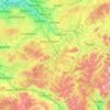
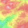
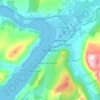
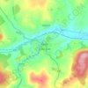
Carte topographique Denton Burn

Cliquez sur la carte pour afficher l’altitude.

À propos de cette carte

Nom : Carte topographique Denton Burn, altitude, relief.

Lieu : Denton Burn, Ascurry Mill, Letham & District, Angus, Scotland, DD8 2QQ, United Kingdom (56.60065 -2.74211 56.60389 -2.73510)

Altitude moyenne : 154 m

Altitude minimum : 114 m

Altitude maximum : 198 m

Autres cartes topographiques

Cliquez sur une carte pour visualiser sa topographie, son altitude et son relief.
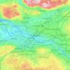
Glasgow

United Kingdom > Scotland > Glasgow City

Glasgow itself was reputed to have been founded by the Christian missionary Saint Mungo in the 6th century. He established a church on the Molendinar Burn, where the present Glasgow Cathedral stands, and in the following years Glasgow became a religious centre. Glasgow grew over the following centuries. The…

Altitude moyenne : 128 m
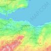
Edinburgh

United Kingdom > Scotland > Edinburgh

Some have called Edinburgh the Athens of the North for a variety of reasons. The earliest comparison between the two cities showed that they had a similar topography, with the Castle Rock of Edinburgh performing a similar role to the Athenian Acropolis. Both of them had flatter, fertile agricultural land…

Altitude moyenne : 104 m
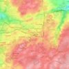
East Kilbride

United Kingdom > Scotland > East Kilbride

Altitude moyenne : 177 m

Peebles

United Kingdom > Scotland > Scottish Borders

Altitude moyenne : 275 m

Dumfries and Galloway

United Kingdom > Scotland

Altitude moyenne : 163 m

Scottish Borders

United Kingdom > Scotland

Altitude moyenne : 257 m

Bunachton

United Kingdom > Scotland > Highland

Altitude moyenne : 237 m

Strathaven

United Kingdom > Scotland > South Lanarkshire

Altitude moyenne : 216 m

Airdrie

United Kingdom > Scotland > North Lanarkshire

Airdrie's name first appeared in the Register of the Great Seal of Scotland (Registrum Magni Sigilii Regum Scotorum) in 1373 as Ardre. By 1546 it had become Ardry and by 1587 it was known as Ardrie. In 1630 it finally appeared in the Register as Airdrie. Given the topography of the area, the most likely…

Altitude moyenne : 135 m
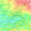
Kilmarnock

United Kingdom > Scotland > East Ayrshire

Altitude moyenne : 56 m

Hawick

United Kingdom > Scotland > Scottish Borders

Altitude moyenne : 199 m

Carluke

United Kingdom > Scotland > South Lanarkshire

Altitude moyenne : 191 m

Dundee

United Kingdom > Scotland > Dundee City

Dundee sits on the north bank of the Firth of Tay on the eastern, North Sea Coast of Scotland. The city lies 36.1 miles (58 km) NNE of Edinburgh and 360.6 miles (580 km) NNW of London. The built-up area occupies a roughly rectangular shape 8.3 miles (13 km) long by 2.5 miles (4 km) wide, aligned in an east to…

Altitude moyenne : 82 m

Buachaille Etive Mor

United Kingdom > Scotland

Altitude moyenne : 585 m

Findhorn

United Kingdom > Scotland > Moray

Altitude moyenne : 3 m

Aberdeen

United Kingdom > Scotland > Aberdeen

Two weather stations collect climate data for the area, Aberdeen/Dyce Airport, and Craibstone. Both are about 4 1⁄2 miles (7 km) to the north west of the city centre, and given that they are in close proximity to each other, exhibit very similar climatic regimes. Dyce tends to have marginally warmer daytime…

Altitude moyenne : 52 m
Penicuik

United Kingdom > Scotland > Midlothian

Altitude moyenne : 247 m

Dunblane

United Kingdom > Scotland > Stirling

Altitude moyenne : 117 m

Eaglesham

United Kingdom > Scotland > East Renfrewshire

Altitude moyenne : 172 m

Livingston

United Kingdom > Scotland > West Lothian

Altitude moyenne : 158 m

Bearsden

United Kingdom > Scotland > East Dunbartonshire

Altitude moyenne : 72 m

Aviemore

United Kingdom > Scotland > Highland

Altitude moyenne : 332 m

Blantyre

United Kingdom > Scotland > South Lanarkshire

Altitude moyenne : 84 m

South Lanarkshire

United Kingdom > Scotland

Altitude moyenne : 289 m

Falkirk

United Kingdom > Scotland

Altitude moyenne : 105 m

Gourock

United Kingdom > Scotland > Inverclyde

Altitude moyenne : 49 m

Dalmellington

United Kingdom > Scotland > East Ayrshire

Altitude moyenne : 285 m

Braidwood

United Kingdom > Scotland > South Lanarkshire

Altitude moyenne : 182 m

Mauchline

United Kingdom > Scotland > East Ayrshire

Altitude moyenne : 125 m

Jedburgh

United Kingdom > Scotland > Scottish Borders

Altitude moyenne : 151 m

Hebrides

United Kingdom > Scotland

Altitude moyenne : 94 m

Cumbernauld

United Kingdom > Scotland > North Lanarkshire > Cumbernauld

Cumbernauld's name probably comes from the Gaelic comar nan allt, meaning "meeting of the burns or streams". There are differing views as to the etymology of this. One theory is that from its high point in the Central Belt, its streams flow both west to the River Clyde and east to the Firth of Forth so…

Altitude moyenne : 111 m

Midlothian

United Kingdom > Scotland

Altitude moyenne : 236 m

North Lanarkshire

United Kingdom > Scotland

Altitude moyenne : 149 m

Highland

United Kingdom > Scotland

Altitude moyenne : 183 m

Perth and Kinross

United Kingdom > Scotland

Altitude moyenne : 338 m

City of Edinburgh

United Kingdom > Scotland

Edinburgh has been popularly called the Athens of the North since the early 19th century. References to Athens, such as Athens of Britain and Modern Athens, had been made as early as the 1760s. The similarities were seen to be topographical but also intellectual. Edinburgh's Castle Rock reminded returning…

Altitude moyenne : 118 m

Cumnock

United Kingdom > Scotland > East Ayrshire

Altitude moyenne : 187 m

River Clyde

United Kingdom > Scotland

Altitude moyenne : 245 m

Hamilton

United Kingdom > Scotland > South Lanarkshire

Altitude moyenne : 88 m

Rosewell

United Kingdom > Scotland > Midlothian

Altitude moyenne : 152 m

Raasay

United Kingdom > Scotland > Highland > Oskaig

Altitude moyenne : 64 m

Bo'ness

United Kingdom > Scotland > Falkirk

Altitude moyenne : 29 m

Shotts

United Kingdom > Scotland > North Lanarkshire

Altitude moyenne : 231 m

Lewis

United Kingdom > Scotland > Western Isles

Altitude moyenne : 42 m

Renfrewshire

United Kingdom > Scotland

Altitude moyenne : 104 m

Aberdeenshire

United Kingdom > Scotland

Altitude moyenne : 199 m

Scottish Highlands

United Kingdom > Scotland > Highland

The Scottish Highlands are renowned for their rugged, mountainous terrain that dominates much of the region. Stretching across the northern and central parts of Scotland, the landscape is shaped by ancient geological forces, including the Caledonian Orogeny, which caused significant tectonic collisions…

Altitude moyenne : 907 m

East Kilbride

United Kingdom > Scotland > South Lanarkshire

The earliest-known evidence of occupation in the area dates as far back as the late Neolithic and Early Bronze Age, as archaeological investigation has demonstrated that burial cairns in the district began as ceremonial or ritual sites of burial during the Neolithic, with the use of cup-marked, and other…

Altitude moyenne : 174 m

Lesmahagow

United Kingdom > Scotland > South Lanarkshire

Altitude moyenne : 226 m

Dunfermline

United Kingdom > Scotland > Fife

Altitude moyenne : 114 m

Blyth Bridge

United Kingdom > Scotland > Scottish Borders

Altitude moyenne : 252 m

Maybole

United Kingdom > Scotland > South Ayrshire

Altitude moyenne : 113 m

Newcastleton

United Kingdom > Scotland > Scottish Borders

Altitude moyenne : 164 m

Kintyre

United Kingdom > Scotland > Argyll and Bute

Altitude moyenne : 61 m

Inverness

United Kingdom > Scotland > Highland

Altitude moyenne : 163 m

Kirkcaldy

United Kingdom > Scotland > Fife

Towards the end of the 16th century, a detailed assessment on the size of the townscape was carried out. The first estimate of the parish population in 1639 was between 3,000 and 3,200 and around 3,400 by 1691. At the beginning of the 18th century, the population declined. A census by Webster's Topographical…

Altitude moyenne : 50 m

Greenock

United Kingdom > Scotland > Inverclyde

Altitude moyenne : 80 m

Bathgate

United Kingdom > Scotland > West Lothian

In the 1846 book A Topographical Dictionary of Scotland, Samuel Lewis writes.

Altitude moyenne : 167 m

Linlithgow

United Kingdom > Scotland > West Lothian

Altitude moyenne : 95 m

Montrose

United Kingdom > Scotland > Angus

Montrose occupies a position on the North Bank of Montrose Basin at the mouth of the River South Esk on the East Coast of Scotland, 11 miles (18 km) NNE of Arbroath, 19 miles (31 km) SW of Stonehaven, and 7.2 miles (12 km) ESE of Brechin. The town lies 62.2 miles (100 km) NNE of Edinburgh, and 373.2 miles (601…

Altitude moyenne : 22 m

Argyll and Bute

United Kingdom > Scotland

Altitude moyenne : 683 m

Aberchirder

United Kingdom > Scotland > Aberdeenshire

Altitude moyenne : 138 m

Larkhall

United Kingdom > Scotland > South Lanarkshire

Altitude moyenne : 114 m

Aboyne

United Kingdom > Scotland > Aberdeenshire

Altitude moyenne : 188 m

Haddington

United Kingdom > Scotland > East Lothian

Altitude moyenne : 78 m

New Cumnock

United Kingdom > Scotland > East Ayrshire

Altitude moyenne : 275 m

Fort William

United Kingdom > Scotland > Highland

Fort William has an oceanic climate (Cfb) with moderate, but generally cool, temperatures and abundant precipitation. In the towns immediate vicinity, there are significant variations in elevation, which leads to some uninhabited areas near the town having a subpolar oceanic climate (Cfc), or, at the absolute…

Altitude moyenne : 122 m

Fife

United Kingdom > Scotland

Altitude moyenne : 67 m

Dundee City

United Kingdom > Scotland

Altitude moyenne : 74 m

Ben Nevis

United Kingdom > Scotland > Highland

Ben Nevis has a highland (alpine) maritime (oceanic) polar climate (ET climate in the Köppen classification). Ben Nevis's elevation, maritime location and topography frequently lead to cool and cloudy weather conditions, which can pose a danger to ill-equipped walkers. According to the observations carried…

Altitude moyenne : 912 m

East Ayrshire

United Kingdom > Scotland

East Ayrshire is located on the west coat of Scotland, sharing borders with the following neighbouring council areas; North Ayrshire, South Ayrshire, Dumfries and Galloway, East Renfrewshire and South Lanarkshire. Blackcraig Hill reaches an elevation of 2,298 feet (700 metres), the highest peak in East…

Altitude moyenne : 225 m

Ayrshire

United Kingdom > Scotland

Altitude moyenne : 141 m

Mull of Kintyre

United Kingdom > Scotland

Ailsa Craig and the County Antrim coast of Ulster and Rathlin Island are all clearly visible from the Mull. On clearer days it is also possible to make out Malin Head in Inishowen in County Donegal in the west of Ulster, and the Ayrshire coast on the other side of Ailsa Craig. Other islands in the Firth of…

Altitude moyenne : 84 m

Newburgh

United Kingdom > Scotland > Aberdeenshire

Altitude moyenne : 18 m

Selkirk

United Kingdom > Scotland > Scottish Borders

Altitude moyenne : 226 m

Burian Hole

United Kingdom > Scotland

Altitude moyenne : 36 m

Keith

United Kingdom > Scotland > Moray

Altitude moyenne : 180 m

Yieldshields

United Kingdom > Scotland > South Lanarkshire

Altitude moyenne : 257 m

Bonhill

United Kingdom > Scotland > West Dunbartonshire

Altitude moyenne : 101 m

Inverness-shire

United Kingdom > Scotland

Altitude moyenne : 333 m

West Calder

United Kingdom > Scotland > West Lothian

Altitude moyenne : 179 m

Oldmeldrum

United Kingdom > Scotland > Aberdeenshire

Altitude moyenne : 121 m

Tweedsmuir

United Kingdom > Scotland > Scottish Borders

Altitude moyenne : 346 m

Killearn

United Kingdom > Scotland > Stirling

Altitude moyenne : 82 m

Coldstream

United Kingdom > Scotland > Scottish Borders

Altitude moyenne : 52 m
Duns

United Kingdom > Scotland > Berwickshire

Altitude moyenne : 131 m

Highlands

United Kingdom > Scotland > Highland

Altitude moyenne : 308 m

Clackmannanshire

United Kingdom > Scotland

Altitude moyenne : 175 m

Auchenblae

United Kingdom > Scotland > Aberdeenshire

Altitude moyenne : 133 m

Moray

United Kingdom > Scotland

Altitude moyenne : 281 m

East Calder

United Kingdom > Scotland > West Lothian

Altitude moyenne : 140 m

Western Isles

United Kingdom > Scotland

Altitude moyenne : 57 m

Inverclyde

United Kingdom > Scotland

Altitude moyenne : 141 m

Balmaha

United Kingdom > Scotland > Stirling

Altitude moyenne : 50 m

St Mary's

United Kingdom > Scotland > Orkney Islands

Altitude moyenne : 8 m

Équipez-vous pour votre prochaine aventure :

🛠️Outil multifonction vélo - Réparez les pannes mécaniques courantes sur le bord du chemin
🎒Housse de sac à dos - Protection supplémentaire pour garder vos affaires au sec
🧤Chaufferettes - Un confort indispensable pour les journées de grand froid
🥤Gobelet pliable - Gain de place maximal pour boire aux fontaines
🧥Doudounes compressibles - Isolation légère pour montagne

En tant que Partenaire Amazon, ce site perçoit une commission sur les achats éligibles sans surcoût pour vous.