Géolocaliser

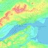
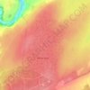
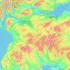
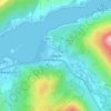
Carte topographique Stirling

Cliquez sur la carte pour afficher l’altitude.

À propos de cette carte

Nom : Carte topographique Stirling, altitude, relief.

Lieu : Stirling, Scotland, United Kingdom (55.95723 -4.85450 56.54710 -3.79792)

Altitude moyenne : 293 m

Altitude minimum : 0 m

Altitude maximum : 1’204 m

Autres cartes topographiques

Cliquez sur une carte pour visualiser sa topographie, son altitude et son relief.
Edinburgh

United Kingdom > Scotland > Edinburgh

Some have called Edinburgh the Athens of the North for a variety of reasons. The earliest comparison between the two cities showed that they had a similar topography, with the Castle Rock of Edinburgh performing a similar role to the Athenian Acropolis. Both of them had flatter, fertile agricultural land…

Altitude moyenne : 104 m
Glasgow

United Kingdom > Scotland > Glasgow City

Glasgow itself was reputed to have been founded by the Christian missionary Saint Mungo in the 6th century. He established a church on the Molendinar Burn, where the present Glasgow Cathedral stands, and in the following years Glasgow became a religious centre. Glasgow grew over the following centuries. The…

Altitude moyenne : 128 m

Buachaille Etive Mor

United Kingdom > Scotland

Altitude moyenne : 585 m

Dundee

United Kingdom > Scotland > Dundee City

Dundee sits on the north bank of the Firth of Tay on the eastern, North Sea Coast of Scotland. The city lies 36.1 miles (58 km) NNE of Edinburgh and 360.6 miles (580 km) NNW of London. The built-up area occupies a roughly rectangular shape 8.3 miles (13 km) long by 2.5 miles (4 km) wide, aligned in an east to…

Altitude moyenne : 82 m

Peebles

United Kingdom > Scotland > Scottish Borders

Altitude moyenne : 275 m

Cruden Bay

United Kingdom > Scotland > Aberdeenshire

Altitude moyenne : 22 m

Aviemore

United Kingdom > Scotland > Highland

Altitude moyenne : 332 m

Dunblane

United Kingdom > Scotland > Stirling

Altitude moyenne : 117 m

Bunachton

United Kingdom > Scotland > Highland

Altitude moyenne : 237 m

Glasgow

United Kingdom > Scotland > Glasgow City

Glasgow itself was reputed to have been founded by the Christian missionary Saint Mungo in the 6th century. He established a church on the Molendinar Burn, where the present Glasgow Cathedral stands, and in the following years Glasgow became a religious centre. Glasgow grew over the following centuries as part…

Altitude moyenne : 128 m
Aberdeen

United Kingdom > Scotland > Aberdeen

Two weather stations collect climate data for the area, Aberdeen/Dyce Airport, and Craibstone. Both are about 4 1⁄2 miles (7 km) to the north west of the city centre, and given that they are in close proximity to each other, exhibit very similar climatic regimes. Dyce tends to have marginally warmer daytime…

Altitude moyenne : 52 m
Falkirk

United Kingdom > Scotland > Falkirk

Falkirk is located in an area of undulating topography between the Slamannan Plateau and the upper reaches of the Firth of Forth. The area to the north of Falkirk is part of the floodplain of the River Carron. Two tributaries of the River Carron - the East Burn and the West Burn flow through the town and form…

Altitude moyenne : 69 m
Forres

United Kingdom > Scotland > Moray

Altitude moyenne : 31 m

Carluke

United Kingdom > Scotland > South Lanarkshire

Altitude moyenne : 191 m

Penicuik

United Kingdom > Scotland > Midlothian

Altitude moyenne : 247 m

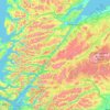
Scottish Highlands

United Kingdom > Scotland > Highland

The entire region was covered by ice sheets during the Pleistocene ice ages, save perhaps for a few nunataks. The complex geomorphology includes incised valleys and lochs carved by the action of mountain streams and ice, and a topography of irregularly distributed mountains whose summits have similar heights…

Altitude moyenne : 907 m
Western Isles

United Kingdom > Scotland

Altitude moyenne : 23 m

Ailsa Craig

United Kingdom > Scotland

In a small glen above Ailsa Castle, a small freshwater body known as the Garry Loch is located at an altitude of 247 m (810 ft), with a depth of at least 17 feet.

Altitude moyenne : 14 m
Alexandra Park

United Kingdom > Scotland > Glasgow City > Glasgow

Altitude moyenne : 50 m

Falkland

United Kingdom > Scotland > Fife

Altitude moyenne : 133 m

Hamilton

United Kingdom > Scotland > South Lanarkshire

Altitude moyenne : 88 m

Garvald

United Kingdom > Scotland > East Lothian

Altitude moyenne : 168 m

Inverness-shire

United Kingdom > Scotland

Altitude moyenne : 333 m

Glenmore

United Kingdom > Scotland > Highland

Altitude moyenne : 200 m

Burntisland

United Kingdom > Scotland > Fife

Altitude moyenne : 47 m

Tomatin

United Kingdom > Scotland > Highland

Altitude moyenne : 345 m

Alness

United Kingdom > Scotland > Highland

Altitude moyenne : 66 m

An Teallach

United Kingdom > Scotland > Highland

Altitude moyenne : 705 m

Crail

United Kingdom > Scotland > Fife

Altitude moyenne : 21 m

Isle of May

United Kingdom > Scotland > Fife

Altitude moyenne : 1 m

Loch Muick

United Kingdom > Scotland > Aberdeenshire

Altitude moyenne : 529 m

The Minch

United Kingdom > Scotland

Altitude moyenne : 63 m

Glenbuck

United Kingdom > Scotland > East Ayrshire

Altitude moyenne : 321 m

Banchory

United Kingdom > Scotland > Aberdeenshire

Altitude moyenne : 117 m

Oban

United Kingdom > Scotland > Argyll and Bute

Altitude moyenne : 52 m

Kilmarnock

United Kingdom > Scotland > East Ayrshire

Altitude moyenne : 56 m

Strathaven

United Kingdom > Scotland > South Lanarkshire

Altitude moyenne : 216 m

Argyll and Bute

United Kingdom > Scotland

Altitude moyenne : 683 m

Hawick

United Kingdom > Scotland > Scottish Borders

Altitude moyenne : 199 m

Airdrie

United Kingdom > Scotland > North Lanarkshire

Airdrie's name first appeared in the Register of the Great Seal of Scotland (Registrum Magni Sigilii Regum Scotorum) in 1373 as Ardre. By 1546 it had become Ardry and by 1587 it was known as Ardrie. In 1630 it finally appeared in the Register as Airdrie. Given the topography of the area, the most likely…

Altitude moyenne : 135 m
Cumbernauld

United Kingdom > Scotland > North Lanarkshire > Cumbernauld

Cumbernauld's name probably comes from the Gaelic comar nan allt, meaning "meeting of the burns or streams". There are differing views as to the etymology of this. One theory is that from its high point in the Central Belt, its streams flow both west to the River Clyde and east to the Firth of Forth so…

Altitude moyenne : 111 m

Dunoon

United Kingdom > Scotland > Argyll and Bute

Altitude moyenne : 98 m

The Campsie Fells

United Kingdom > Scotland

Altitude moyenne : 431 m

Ayrshire

United Kingdom > Scotland

Altitude moyenne : 141 m

Inchmickery

United Kingdom > Scotland

Altitude moyenne : 0 m

Iona

United Kingdom > Scotland

Altitude moyenne : 9 m

Banffshire

United Kingdom > Scotland

Altitude moyenne : 191 m

Stirlingshire

United Kingdom > Scotland

Altitude moyenne : 222 m

Mull of Kintyre

United Kingdom > Scotland

Ailsa Craig and the County Antrim coast of Ulster and Rathlin Island are all clearly visible from the Mull. On clearer days it is also possible to make out Malin Head in Inishowen in County Donegal in the west of Ulster, and the Ayrshire coast on the other side of Ailsa Craig. Other islands in the Firth of…

Altitude moyenne : 84 m

Glen Dochart

United Kingdom > Scotland

Altitude moyenne : 469 m

Auchencorth Moss

United Kingdom > Scotland

Altitude moyenne : 281 m

Denton Burn

United Kingdom > Scotland

Altitude moyenne : 154 m

Taynish Island

United Kingdom > Scotland

Altitude moyenne : 11 m

Devil's Beef Tub

United Kingdom > Scotland

Altitude moyenne : 376 m

Grey Mare's Tail

United Kingdom > Scotland

Altitude moyenne : 466 m

Meall Aundrary

United Kingdom > Scotland

Altitude moyenne : 194 m

River Kerry

United Kingdom > Scotland

Altitude moyenne : 118 m

Abhainn a' Ghlinne Ghil

United Kingdom > Scotland

Altitude moyenne : 138 m

Burian Hole

United Kingdom > Scotland

Altitude moyenne : 36 m

Papa

United Kingdom > Scotland

Altitude moyenne : 2 m

Sgùrr na Stri

United Kingdom > Scotland

Altitude moyenne : 92 m

Braid Hill

United Kingdom > Scotland

Altitude moyenne : 353 m

Sutherland

United Kingdom > Scotland

Altitude moyenne : 109 m

Loch Urigill

United Kingdom > Scotland

Altitude moyenne : 172 m

Highland

United Kingdom > Scotland

Altitude moyenne : 402 m

Glen Croe

United Kingdom > Scotland

Altitude moyenne : 355 m

Barrnacarry Bay

United Kingdom > Scotland

Altitude moyenne : 32 m

Snap

United Kingdom > Scotland

Altitude moyenne : 3 m

Coldstream

United Kingdom > Scotland > Scottish Borders

Altitude moyenne : 52 m

Patna

United Kingdom > Scotland > East Ayrshire

Altitude moyenne : 209 m

Lanarkshire

United Kingdom > Scotland

Altitude moyenne : 183 m

Braidwood

United Kingdom > Scotland > South Lanarkshire

Altitude moyenne : 182 m

Rubha nam Bùthan

United Kingdom > Scotland

Altitude moyenne : 15 m

Firth of Clyde

United Kingdom > Scotland

Altitude moyenne : 0 m

St Magnus' Bay

United Kingdom > Scotland

Altitude moyenne : 6 m

Findhorn

United Kingdom > Scotland > Moray

Altitude moyenne : 3 m

Inverness

United Kingdom > Scotland > Highland

Altitude moyenne : 163 m

Jedburgh

United Kingdom > Scotland > Scottish Borders

Altitude moyenne : 151 m

Brechin

United Kingdom > Scotland > Angus

Altitude moyenne : 71 m

Dunfermline

United Kingdom > Scotland > Fife > Dunfermline

Altitude moyenne : 80 m

Eaglesham

United Kingdom > Scotland > East Renfrewshire

Altitude moyenne : 172 m

Bo'ness

United Kingdom > Scotland > Falkirk

Altitude moyenne : 29 m

Greenock

United Kingdom > Scotland > Inverclyde

Altitude moyenne : 80 m

Livingston

United Kingdom > Scotland > West Lothian

Altitude moyenne : 158 m

Aberchirder

United Kingdom > Scotland > Aberdeenshire

Altitude moyenne : 138 m

Douglas

United Kingdom > Scotland > South Lanarkshire

Altitude moyenne : 256 m

Bearsden

United Kingdom > Scotland > East Dunbartonshire

Altitude moyenne : 72 m

Glencoe

United Kingdom > Scotland > Highland

Altitude moyenne : 114 m

Paisley

United Kingdom > Scotland > Renfrewshire

Altitude moyenne : 33 m

Blantyre

United Kingdom > Scotland > South Lanarkshire

Altitude moyenne : 84 m

Prestwick

United Kingdom > Scotland > South Ayrshire

Altitude moyenne : 18 m

Barrhead

United Kingdom > Scotland > East Renfrewshire

Altitude moyenne : 93 m

Équipez-vous pour votre prochaine aventure :

🕶️Lunettes de soleil montagne - Protection UV en altitude
🧭Boussole de précision - Idéale pour l'orientation avec cartes topographiques en milieu alpin
📏Podomètre de distance - Mesurez précisément vos pas et la distance parcourue lors de vos sorties
🌍Globes terrestres - Visualisation géographique
🍽️Popotes de camping - Ustensiles légers pour repas en bivouac

En tant que Partenaire Amazon, ce site perçoit une commission sur les achats éligibles sans surcoût pour vous.