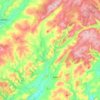
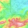
Carte topographique Cefn Coch
Cliquez sur la carte pour afficher l’altitude.
À propos de cette carte

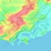
Nom : Carte topographique Cefn Coch, altitude, relief.
Lieu : Cefn Coch, Powys, Wales, LD5 4TR, United Kingdom (52.17229 -3.71860 52.17239 -3.71850)
Altitude moyenne : 458 m
Altitude minimum : 312 m
Altitude maximum : 511 m
Autres cartes topographiques
Cliquez sur une carte pour visualiser sa topographie, son altitude et son relief.


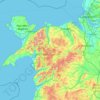



Pembrokeshire
There is little evidence of Roman occupation in what is now Pembrokeshire. Ptolemy's Geography, written c. 150, mentioned some coastal places, two of which have been identified as the River Teifi and what is now St Davids Head, but most Roman writers did not mention the area; there may have been a Roman…
Altitude moyenne : 43 m




Torfaen
Exterior A large iron framed market hall with two full elevations and three secondary entrances through other street frontages, eg. Jubilee Building, Crane Street. Built of grey narrow coursed rock faced pennant limestone with some larger stones, and with yellow Ebbw Vale brick dressings and a Welsh slate…
Altitude moyenne : 206 m


Merthyr Tydfil County Borough
Merthyr Tydfil Golf Club is situated on the southeastern slopes of Cefn Cil Sanws, a rough gritstone and limestone hill in the north-west of the County Borough. It is one of the highest golf courses in Britain. Morlais Castle Golf Club is situated adjacent to the ruins of Morlais Castle on Morlais Hill,…
Altitude moyenne : 328 m
Brecon Beacons National Park
United Kingdom > Wales > Powys
Brecon Beacons National Park, officially named Bannau Brycheiniog National Park (Welsh pronunciation), is a national park in Wales. It is named after the Brecon Beacons (Welsh: Bannau Brycheiniog), the mountain range at its centre. The national park includes the highest mountain in South Wales, Pen y Fan,…
Altitude moyenne : 270 m






Puncheston
United Kingdom > Wales > Pembrokeshire
A map of 1578 shows the parish as Castle Male, presumably a phonetic spelling of the Welsh name by the English mapmaker. Lewis's Topographical Dictionary of 1844 gives 326 inhabitants (the 1849 edition gives 255) for the parish, which includes the village and a number of outlying residences and farms. Lewis…
Altitude moyenne : 165 m




Grwyne Fawr Reservoir
United Kingdom > Wales > Powys
By the end of the 19th-century there were serious water shortages in the western parts of the historic county of Monmouthshire. The area had seen a massive population increase as a result of the steel and coal industries but the supply of water to the area was complicated due to its high altitude. A site for a…
Altitude moyenne : 619 m



Morfa Harlech National Nature Reserve
United Kingdom > Wales > Gwynedd > Harlech
Altitude moyenne : 3 m

Parc Tan-y-Bwlch
United Kingdom > Wales > Gwynedd > Mynydd Llandygái > Pen Y Bwlch
Altitude moyenne : 293 m