Géolocaliser

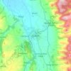
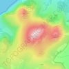
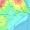
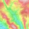
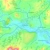
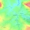
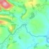
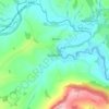
Carte topographique Taff

Cliquez sur la carte pour afficher l’altitude.

À propos de cette carte

Nom : Carte topographique Taff, altitude, relief.

Lieu : Taff, Merthyr Tydfil, Wales, CF47 8LL, United Kingdom (51.63178 -3.39644 51.75512 -3.30758)

Altitude moyenne : 270 m

Altitude minimum : 70 m

Altitude maximum : 495 m

Autres cartes topographiques

Cliquez sur une carte pour visualiser sa topographie, son altitude et son relief.
North Wales

United Kingdom > Wales

Altitude moyenne : 125 m

Cardiff

United Kingdom > Wales > Cardiff

Altitude moyenne : 55 m

Snowdon

United Kingdom > Wales > Gwynedd

Snowdon (/ˈsnoʊdən/) or Yr Wyddfa (pronounced [ər ˈʊɨ̞̯ðva] (listen)), is the highest mountain in Wales, at an elevation of 1,085 metres (3,560 ft) above sea level, and the highest point in the British Isles outside the Scottish Highlands. It is located in Snowdonia National Park (Parc Cenedlaethol…

Altitude moyenne : 692 m
Wrexham

United Kingdom > Wales

Altitude moyenne : 150 m

Isle of Anglesey

United Kingdom > Wales

Altitude moyenne : 49 m

South Wales

United Kingdom > Wales

Altitude moyenne : 163 m

Ruthin

United Kingdom > Wales > Denbighshire

The Myddleton Arms is also known as the Seven Eyes. It is said to have been built in the 14th century. The Dutch style design, long, steeped roof is attributed to Sir Richard Clough, an Elizabethan merchant. It has four tiers of dormer windows, each at a different elevation, known locally as the seven eyes of…

Altitude moyenne : 162 m
Barry

United Kingdom > Wales > Vale of Glamorgan

Altitude moyenne : 29 m

Cwmtillery

United Kingdom > Wales > Blaenau Gwent

Altitude moyenne : 395 m

Corris

United Kingdom > Wales > Gwynedd

Altitude moyenne : 248 m

Llansilin

United Kingdom > Wales > Powys

Altitude moyenne : 235 m

Caerleon

United Kingdom > Wales > Newport > Caerleon

Altitude moyenne : 37 m

Bridgend County Borough

United Kingdom > Wales

Altitude moyenne : 160 m

Conwy

United Kingdom > Wales

Altitude moyenne : 254 m

Usk

United Kingdom > Wales > Monmouthshire

The origin of the Welsh name Brynbuga (Welsh: [brɨ̞nˈbɨ̞ga]) is less certain. The local Brythonic name adopted into Latin as Burrium or Burrio was recorded as Brunebegy and Burenbegie in the 15th century. The modern name is likely an example of the linguistic metathesis common in Welsh Topography. Folk…

Altitude moyenne : 66 m
Pembrokeshire

United Kingdom > Wales

There is little evidence of Roman occupation in what is now Pembrokeshire. Ptolemy's Geography, written c. 150, mentioned some coastal places, two of which have been identified as the River Teifi and what is now St Davids Head, but most Roman writers did not mention the area; there may have been a Roman…

Altitude moyenne : 43 m
Carmarthenshire

United Kingdom > Wales

Altitude moyenne : 142 m

Powys

United Kingdom > Wales

Altitude moyenne : 216 m

Monmouthshire

United Kingdom > Wales

Altitude moyenne : 136 m

Rhondda Cynon Taf

United Kingdom > Wales

Altitude moyenne : 251 m

Ceredigion

United Kingdom > Wales

Altitude moyenne : 213 m

Vale of Glamorgan

United Kingdom > Wales

Altitude moyenne : 56 m

Gwynedd

United Kingdom > Wales

Altitude moyenne : 199 m

Denbighshire

United Kingdom > Wales

Altitude moyenne : 213 m

West Wales and the Valleys

United Kingdom > Wales

Altitude moyenne : 102 m

Neath Port Talbot

United Kingdom > Wales

Altitude moyenne : 188 m

Flintshire

United Kingdom > Wales

Altitude moyenne : 104 m

River Dee

United Kingdom > Wales

Altitude moyenne : 157 m

Torfaen

United Kingdom > Wales

Exterior A large iron framed market hall with two full elevations and three secondary entrances through other street frontages, eg. Jubilee Building, Crane Street. Built of grey narrow coursed rock faced pennant limestone with some larger stones, and with yellow Ebbw Vale brick dressings and a Welsh slate…

Altitude moyenne : 206 m
Blaenau Gwent

United Kingdom > Wales

Altitude moyenne : 358 m

Newport

United Kingdom > Wales

Altitude moyenne : 58 m

Foel Penolau

United Kingdom > Wales

Altitude moyenne : 423 m

Ysgafell Wen

United Kingdom > Wales

Altitude moyenne : 517 m

Moel Yr Hydd

United Kingdom > Wales

Altitude moyenne : 429 m

Llanelly

United Kingdom > Wales

Altitude moyenne : 306 m

Ystradgynlais

United Kingdom > Wales

Altitude moyenne : 285 m

The Vale of Grwyney

United Kingdom > Wales

Altitude moyenne : 329 m

Fron Goch

United Kingdom > Wales

Altitude moyenne : 196 m

Ammanford

United Kingdom > Wales

Altitude moyenne : 55 m

Yr Eifl

United Kingdom > Wales

Altitude moyenne : 257 m

Mynydd Carningli

United Kingdom > Wales

Altitude moyenne : 213 m

Llandinam

United Kingdom > Wales

Altitude moyenne : 297 m

Dudwell Mountain

United Kingdom > Wales

Altitude moyenne : 118 m

Maenclochog

United Kingdom > Wales

Altitude moyenne : 182 m

Penrice

United Kingdom > Wales

Altitude moyenne : 55 m

Cefn Coch

United Kingdom > Wales

Altitude moyenne : 328 m

Cefn Coch

United Kingdom > Wales

Altitude moyenne : 458 m

Merthyr Tydfil County Borough

United Kingdom > Wales

Merthyr Tydfil Golf Club is situated on the southeastern slopes of Cefn Cil Sanws, a rough gritstone and limestone hill in the north-west of the County Borough. It is one of the highest golf courses in Britain. Morlais Castle Golf Club is situated adjacent to the ruins of Morlais Castle on Morlais Hill,…

Altitude moyenne : 328 m

Swansea

United Kingdom > Wales

Altitude moyenne : 76 m

Gwynedd

United Kingdom > Wales

Altitude moyenne : 332 m

Powys

United Kingdom > Wales

Altitude moyenne : 285 m

Isle of Anglesey

United Kingdom > Wales

Altitude moyenne : 65 m

Caerphilly County Borough

United Kingdom > Wales

Altitude moyenne : 228 m

Tremadog Bay

United Kingdom > Wales

Altitude moyenne : 0 m

Wrexham

United Kingdom > Wales > Wrexham

Altitude moyenne : 139 m

Aberystwyth

United Kingdom > Wales > Ceredigion

Aberystwyth experiences an oceanic climate (Köppen climate classification Cfb) similar to almost all of the United Kingdom. This is particularly pronounced due to its west coast location facing the Irish Sea. Air undergoes little land moderation and so temperatures closely reflect the sea temperature when…

Altitude moyenne : 39 m
Abergavenny

United Kingdom > Wales > Monmouthshire

Altitude moyenne : 187 m

Crickhowell

United Kingdom > Wales > Powys

Altitude moyenne : 253 m

Chepstow

United Kingdom > Wales > Monmouthshire

Altitude moyenne : 57 m

Brecon Beacons National Park

United Kingdom > Wales > Powys

Brecon Beacons National Park, officially named Bannau Brycheiniog National Park (Welsh pronunciation), is a national park in Wales. It is named after the Brecon Beacons (Welsh: Bannau Brycheiniog), the mountain range at its centre. The national park includes the highest mountain in South Wales, Pen y Fan,…

Altitude moyenne : 270 m
Llanybydder

United Kingdom > Wales > Carmarthenshire

Altitude moyenne : 147 m

Gower Peninsula

United Kingdom > Wales > Swansea

Altitude moyenne : 85 m

Gyrn Goch

United Kingdom > Wales > Gwynedd

Altitude moyenne : 251 m

Milford Haven

United Kingdom > Wales > Pembrokeshire

One of the earliest notable figures from the Milford Haven area is Howell Davis, a pirate born in 1680. He was shot dead in 1719 on the Portuguese island of Príncipe. Other famous residents connected as seafarers include Isaac Davis, a former seaman who was engaged in the fur trade between the Pacific…

Altitude moyenne : 36 m

Black Mountains

United Kingdom > Wales > Powys > Hay on Wye

Altitude moyenne : 373 m

Snowdonia

United Kingdom > Wales > Gwynedd > Beddgelert

Altitude moyenne : 700 m

Bargoed

United Kingdom > Wales > Caerphilly County Borough

Altitude moyenne : 244 m

Pontcanna

United Kingdom > Wales > Cardiff > Cardiff

Altitude moyenne : 15 m

Ilston

United Kingdom > Wales > Swansea

Altitude moyenne : 61 m

Moel Famau

United Kingdom > Wales > Denbighshire

Altitude moyenne : 375 m

Wenvoe

United Kingdom > Wales > Vale of Glamorgan

Altitude moyenne : 72 m

Pontyclun

United Kingdom > Wales > Rhondda Cynon Taf

Altitude moyenne : 72 m

Cwm Ivy

United Kingdom > Wales > Swansea

Altitude moyenne : 34 m

Uplands

United Kingdom > Wales > Swansea > Swansea

Altitude moyenne : 50 m

Knollbury

United Kingdom > Wales > Monmouthshire > Magor

Altitude moyenne : 30 m

Maerdy

United Kingdom > Wales > Rhondda Cynon Taf

Altitude moyenne : 342 m

Plas-yn-pentre

United Kingdom > Wales > Denbighshire

Altitude moyenne : 183 m

Mathern

United Kingdom > Wales > Monmouthshire

Altitude moyenne : 27 m

Bangor

United Kingdom > Wales > Bangor

Altitude moyenne : 149 m

Newport

United Kingdom > Wales > Newport

Altitude moyenne : 89 m

Swansea

United Kingdom > Wales > Swansea

Much of Swansea is hilly with the main area of upland being located in the council ward of Mawr. Areas up to 185 metres (607 ft) in elevation range across the central section: Kilvey Hill, Townhill and Llwynmawr separate the centre of Swansea from its northern suburbs. Cefn Bryn, a ridge of high land, is the…

Altitude moyenne : 73 m
Pontardawe

United Kingdom > Wales > Neath Port Talbot

Altitude moyenne : 161 m

Trawsfynydd

United Kingdom > Wales > Gwynedd

Altitude moyenne : 234 m

Caerleon

United Kingdom > Wales > Gwent > Newport > Caerleon

Altitude moyenne : 37 m

Brecon

United Kingdom > Wales > Powys

Altitude moyenne : 216 m

Builth Wells

United Kingdom > Wales > Powys

Altitude moyenne : 232 m

Llandrindod Wells

United Kingdom > Wales > Powys

Altitude moyenne : 247 m

Thornhill

United Kingdom > Wales > Cardiff

Altitude moyenne : 99 m

Llanddewi

United Kingdom > Wales > Swansea

Altitude moyenne : 63 m

Banc Y Garth

United Kingdom > Wales > Carmarthenshire

Altitude moyenne : 342 m

Neyland

United Kingdom > Wales > Pembrokeshire

Altitude moyenne : 29 m

Ton-Mawr

United Kingdom > Wales > Neath Port Talbot

Altitude moyenne : 222 m

Beulah

United Kingdom > Wales > Powys

Altitude moyenne : 239 m

Beulah

United Kingdom > Wales > Ceredigion

Altitude moyenne : 140 m

Colwyn Bay

United Kingdom > Wales > Conwy

Altitude moyenne : 68 m

Llandudno

United Kingdom > Wales > Conwy

Altitude moyenne : 19 m

Grosmont

United Kingdom > Wales > Monmouthshire

Altitude moyenne : 128 m

Équipez-vous pour votre prochaine aventure :

🏞️Jumelles compactes - Observation en nature
🦯Bâtons de marche - Réduisez la fatigue musculaire lors des fortes pentes et descentes
🔌Chargeurs solaires - Autonomie énergétique
📍GPS de randonnée - Navigation précise hors réseau
🧥Vestes imperméables de randonnée - Protection contre la pluie et le vent en terrain variable

En tant que Partenaire Amazon, ce site perçoit une commission sur les achats éligibles sans surcoût pour vous.