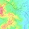
Carte topographique Caulcott
Cliquez sur la carte pour afficher l’altitude.
À propos de cette carte

Nom : Carte topographique Caulcott, altitude, relief.
Altitude moyenne : 105 m
Altitude minimum : 67 m
Altitude maximum : 131 m
Autres cartes topographiques
Cliquez sur une carte pour visualiser sa topographie, son altitude et son relief.




Hanborough
United Kingdom > England > Oxfordshire > West Oxfordshire > Church Hanborough
Altitude moyenne : 83 m

Letcombe Bassett
United Kingdom > England > Oxfordshire > Vale of White Horse
Altitude moyenne : 177 m




Botley and North Hinksey
United Kingdom > England > Oxfordshire > Vale of White Horse
Altitude moyenne : 78 m


Stratton Audley
United Kingdom > England > Oxfordshire > Cherwell District > Stratton Audley
Altitude moyenne : 92 m


Clifton Hampden
United Kingdom > England > Oxfordshire > South Oxfordshire > Clifton Hampden
Altitude moyenne : 58 m



Harpsden Wood
United Kingdom > England > Oxfordshire > South Oxfordshire > Henley-on-Thames > Harpsden
Altitude moyenne : 63 m
Watlington Hill
United Kingdom > England > Oxfordshire > South Oxfordshire > Watlington
Altitude moyenne : 189 m

Kingwood Common
United Kingdom > England > Oxfordshire > South Oxfordshire > Highmoor
Altitude moyenne : 125 m

Didcot
United Kingdom > England > Oxfordshire > South Oxfordshire > East Hagbourne
Altitude moyenne : 61 m

The Spinney
United Kingdom > England > Oxfordshire > Vale of White Horse > Kingston Bagpuize
Altitude moyenne : 77 m
Goring-on-Thames
United Kingdom > England > Oxfordshire > South Oxfordshire > Goring-on-Thames
Altitude moyenne : 87 m

Appleford-on-Thames
United Kingdom > England > Oxfordshire > Vale of White Horse
Altitude moyenne : 51 m


Ashdown Park
United Kingdom > England > Oxfordshire > Vale of White Horse > Ashbury
Altitude moyenne : 185 m
Roman Meadow Banbury Country Park
United Kingdom > England > Oxfordshire > Cherwell District > Little Bourton
Altitude moyenne : 103 m


Cowleaze Wood
United Kingdom > England > Oxfordshire > South Oxfordshire > Lewknor
Altitude moyenne : 209 m


Vale of White Horse
United Kingdom > England > Oxfordshire
As well as being a local authority district, the Vale of White Horse is a geographical, historical and cultural region. The name "Vale of White Horse" predates the present-day local authority district, having been described, for example, in Daniel Defoe's 1748 travel account A Tour thro' the Whole Island of…
Altitude moyenne : 105 m

Sonning Eye
United Kingdom > England > Oxfordshire > South Oxfordshire > Dunsden Green > Sonning Eye
Altitude moyenne : 44 m

Wytham Woods
United Kingdom > England > Oxfordshire > Vale of White Horse > Farmoor
Altitude moyenne : 84 m

Ducklington
United Kingdom > England > Oxfordshire > West Oxfordshire > Ducklington
Altitude moyenne : 80 m

Weston-on-the-Green
United Kingdom > England > Oxfordshire > Cherwell District
Altitude moyenne : 72 m


Sonning Common
United Kingdom > England > Oxfordshire > South Oxfordshire > Sonning Common
Altitude moyenne : 88 m



Chipping Norton
United Kingdom > England > Oxfordshire > West Oxfordshire > Chipping Norton
Altitude moyenne : 194 m



Bicester
United Kingdom > England > Oxfordshire
Bicester has expanded rapidly in recent generations due to the town's picturesque historical town centre, garden town layout, independent and high-street shops, restaurants, as well as a rail connection to Oxford. It also boasts imminent connection to Cambridge, as well as rail links to Birmingham and London.…
Altitude moyenne : 77 m


North Leigh
United Kingdom > England > Oxfordshire > West Oxfordshire > North Leigh
Altitude moyenne : 108 m



East Hagbourne
United Kingdom > England > Oxfordshire > South Oxfordshire > East Hagbourne
Altitude moyenne : 62 m





Stanford in the Vale
United Kingdom > England > Oxfordshire > Vale of White Horse
Altitude moyenne : 79 m