
Carte topographique Lhasa
Carte interactive
Cliquez sur la carte pour afficher l’altitude.
À propos de cette carte
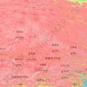
Nom : Carte topographique Lhasa, altitude, relief.
Lieu : Lhasa, Tibet, 850000, China (29.24065 89.75281 36.34330 95.16436)
Altitude moyenne : 4’866 m
Altitude minimum : 2’877 m
Altitude maximum : 7’466 m
Lhasa prefecture-level city roughly corresponds to the basin of the Lhasa River, a major tributary of the Yarlung Tsangpo River. Exceptions are the north of Damxung County, which crosses the watershed of the Nyenchen Tanglha Mountains and includes part of the Namtso lake, and Nyêmo County, which covers the basin of the Nimu Maqu River, a direct tributary of the Yarlung Tsangpo. The river basin is separated from the Yarlung Tsangpo valley to the south by the Goikarla Rigyu range. The largest tributary of the Lhasa River, the Reting Tsangpo, originates in the Chenthangula Mountains in Nagqu Prefecture at an elevation of about 5,500 metres (18,000 ft), and flows southwest into Lhasa past Reting Monastery.
Autres cartes topographiques
Cliquez sur une carte pour visualiser sa topographie, son altitude et son relief.
Chagba
China > Tibet > Rinbung County
Chagba, Rinbung County, Shigatse Prefecture, Tibet, China
Altitude moyenne : 4’695 m
Pangong Tso
China > Tibet > Rutog County
Pangong Tso, Rutog County, Ngari Prefecture, Tibet, China
Altitude moyenne : 5’119 m
Samarda
China > Tibet > Kangmar County
Samarda, Kangmar County, Shigatse Prefecture, Tibet, China
Altitude moyenne : 4’820 m
Chengguan District
Chengguan District, Lhasa, Tibet, 850000, China
Altitude moyenne : 4’325 m
Kampa County
Kampa County, Shigatse Prefecture, Tibet, 857700, China
Altitude moyenne : 4’993 m
Mount Everest
China > Tibet > Tingri County
Mount Everest, Tingri County, Shigatse Prefecture, Tibet, China
Altitude moyenne : 7’851 m
Lhamo Latso
China > Tibet > Gyatsa County > Cuijiu
Lhamo Latso, Cuijiu, Gyatsa County, Shannan, Tibet, China
Altitude moyenne : 5’104 m
Lhoka
China > Tibet > Tsetang Township
Lhoka, Tsetang Township, Nêdong District, Lhoka, Tibet, China
Altitude moyenne : 4’148 m
Ngari
China > Tibet > Gar County > Shiquanhe
Ngari, Shiquanhe, Gar County, Ngari Prefecture, Tibet, China
Altitude moyenne : 4’918 m
Mount Kailash
China > Tibet > Purang County > Darchen
Mount Kailash, Darchen, Purang County, Ngari Prefecture, Tibet, China
Altitude moyenne : 5’748 m
Yadong County
China > Tibet > Yadong County
Yadong County, Shigatse, Tibet, China
Altitude moyenne : 4’040 m
Lake Manasarovar
Lake Manasarovar, Hor Town, Burang, Ngari Prefecture, Tibet, China
Altitude moyenne : 4’604 m