
Carte topographique Walnut Grove
Cliquez sur la carte pour afficher l’altitude.
À propos de cette carte
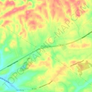
Nom : Carte topographique Walnut Grove, altitude, relief.
Altitude moyenne : 334 m
Altitude minimum : 287 m
Altitude maximum : 375 m
Autres cartes topographiques
Cliquez sur une carte pour visualiser sa topographie, son altitude et son relief.
Douglas Dam
United States > Tennessee > Sevier County
The Douglas Project required the construction of ten smaller, earthen saddle dams to fill in gaps along the adjacent ridgeline and permit a higher water elevation than would otherwise be possible. Most of these saddle dams are located in the hills southeast of the main dam. One protects downtown Dandridge,…
Altitude moyenne : 312 m