Cartes topographiques Tennessee
Cliquez sur une carte pour visualiser sa topographie, son altitude et son relief.

Bays Mountain
United States > Tennessee > Hawkins County
The southern segment of Bays Mountain is relatively low in elevation (up to about 1,300 feet (396.2 m)). In some places it essentially merges with the surrounding plains, especially where it is bisected by the French Broad River and the Nolichucky River. The northern segment of Bays Mountain reaches higher…
Altitude moyenne : 419 m


West Tennessee
West Tennessee is located almost entirely within the Mississippi Embayment, part of the Gulf Coastal Plain. Because of this, the terrain is flatter than the eastern parts of the state. Areas along the Mississippi River are located within the Mississippi Alluvial Plain, which is primarily a floodplain with many…
Altitude moyenne : 127 m

Bristol
United States > Tennessee > Sullivan County > Bristol > Bristol
Like much of the rest of the state, Bristol has a humid subtropical climate (Köppen climate classification: Cfa), although with significantly cooler temperatures, especially in the summer, due to elevation; it is part of USDA hardiness zone 6b, with areas to the southwest falling in zone 7a. The normal…
Altitude moyenne : 579 m
Staffordtown
United States > Tennessee > Polk County > Copperhill
Staffordtown is situated in the scenic Appalachian region, characterized by its rugged terrain and lush forests. The area is marked by steep hills and rolling valleys that define the landscape, with elevations ranging from around 1,500 to 3,000 feet above sea level. The surrounding mountains, part of the…
Altitude moyenne : 478 m

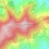


Lascassas Villa
United States > Tennessee > Rutherford County > Murfreesboro > Lascassas Villa
Altitude moyenne : 187 m


Seventeen Seventysix Estates
United States > Tennessee > Davidson County > Nashville > Seventeen Seventysix Estates
Altitude moyenne : 199 m
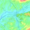
Elizabethton
United States > Tennessee > Carter County > Elizabethton > Elizabethton
The elevation at Elizabethton Municipal Airport is 1,593 feet (486 m) ASL (the highest point of elevation in Carter County is at Roan Mountain with an elevation of 6,285 feet (1,916 m) ASL), and the airport is located on the eastern side of the city along State Highway 91 Stoney Creek Exit. Elizabethton is…
Altitude moyenne : 527 m


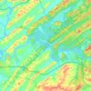


Hopewell
United States > Tennessee > Bradley County
According to the United States Census Bureau, the CDP has a total area of 7.1 square miles (18 km2), all land. It sits at an elevation of approximately 722 feet (220 m) above sea level, one of the lowest elevations in Bradley County.
Altitude moyenne : 254 m


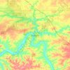


Brookhill
United States > Tennessee > Rutherford County > Murfreesboro > Brookhill
Altitude moyenne : 186 m



Glenwood
United States > Tennessee > Hamilton County > Chattanooga > Ridgeside
Altitude moyenne : 229 m






Alpine Heights
United States > Tennessee > Hamilton County > Chattanooga > Red Bank
Altitude moyenne : 249 m


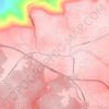
Monteagle
United States > Tennessee > Grundy County > Monteagle
The town straddles a narrow stretch of the Cumberland Plateau known colloquially as "Monteagle Mountain". This stretch of the plateau is approximately 2 miles (3 km) wide, with steep drop-offs to the northwest and southeast. Monteagle lies at an elevation of just under 2,000 feet (610 m) above sea level. By…
Altitude moyenne : 566 m


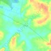

Myrtlewood Estates
United States > Tennessee > Davidson County > Nashville-Davidson
Altitude moyenne : 206 m
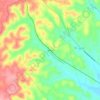


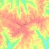

North Chattanooga
United States > Tennessee > Chattanooga > North Chattanooga
Altitude moyenne : 225 m
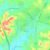
Bellshire
United States > Tennessee > Davidson County > Nashville > Bellshire
Altitude moyenne : 186 m