
Carte topographique Spicewood
Cliquez sur la carte pour afficher l’altitude.
À propos de cette carte
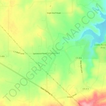
Nom : Carte topographique Spicewood, altitude, relief.
Lieu : Spicewood, Burnet County, Texas, United States (30.45592 -98.17664 30.49592 -98.13664)
Altitude moyenne : 251 m
Altitude minimum : 199 m
Altitude maximum : 308 m
Autres cartes topographiques
Cliquez sur une carte pour visualiser sa topographie, son altitude et son relief.
Inks Lake State Park
United States > Texas > Burnet County > Burnet
Conservation Pool Elevation usually stays around 888.22 ft. msl; however, this lake does fluctuate about 1 foot annually. Inks lake water clarity can be seen as clear to slightly stained mostly throughout the year. It tends to have higher turbidity during the rainy season due to excessive amounts of runoff.
Altitude moyenne : 294 m