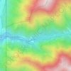
Carte topographique Logan
Cliquez sur la carte pour afficher l’altitude.
Logan
The city lies near the eastern edge of Cache Valley on the western slopes of the Bear River Mountains. Mount Logan rises to an elevation of 9,710 feet (2,960 m) immediately to the east, and south of Logan Canyon. The eastern portions of the city are atop shelf-like "benches", late Pleistocene sedimentary deposits created by the glacially fed Logan River feeding into the northern stretches of Lake Bonneville, building a "Gilbert-type" river delta over several thousand years. The Logan River later cut down through these sedimentary deposits after the draining of Lake Bonneville about 14,500 years ago. This created a low-lying area with very steep slopes that reach into the rest of town and to the Logan River bottomlands. West of Logan lie flatlands that contain both farmland and marshes. North and south of Logan are rapidly growing residential suburbs.
À propos de cette carte
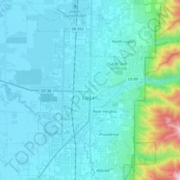
Nom : Carte topographique Logan, altitude, relief.
Lieu : Logan, Cache County, Utah, United States (41.67538 -111.90194 41.79736 -111.78019)
Altitude moyenne : 1’498 m
Altitude minimum : 1’342 m
Altitude maximum : 2’659 m
Autres cartes topographiques
Cliquez sur une carte pour visualiser sa topographie, son altitude et son relief.
Logan Canyon
United States > Utah > Cache County
Logan Canyon is a canyon in the western United States in northeastern Utah, which cuts its way through the Bear River Mountains, a branch of the Wasatch Range. It is popular for both summer and winter activities, especially rock-climbing, hiking, camping, fishing, snowmobiling, and skiing, at the Beaver…
Altitude moyenne : 1’780 m