
Carte topographique Atomic City
Carte interactive
Cliquez sur la carte pour afficher l’altitude.
À propos de cette carte
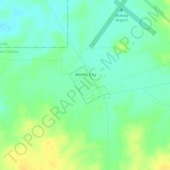
Nom : Carte topographique Atomic City, altitude, relief.
Lieu : Atomic City, Bingham County, Idaho, 83215, United States (43.44020 -112.81630 43.44626 -112.80763)
Altitude moyenne : 1’533 m
Altitude minimum : 1’523 m
Altitude maximum : 1’546 m
Autres cartes topographiques
Cliquez sur une carte pour visualiser sa topographie, son altitude et son relief.
Aberdeen
United States > Idaho > Bingham County
Aberdeen, Bingham County, Idaho, 83210, United States
Altitude moyenne : 1’341 m
Blackfoot
United States > Idaho > Bingham County
Blackfoot, Bingham County, Idaho, 83221, United States
Altitude moyenne : 1’371 m
Fort Hall
United States > Idaho > Bingham County
Fort Hall, Bingham County, Idaho, 83203, United States
Altitude moyenne : 1’356 m