
Carte topographique Central
Cliquez sur la carte pour afficher l’altitude.
À propos de cette carte
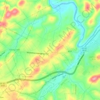
Nom : Carte topographique Central, altitude, relief.
Altitude moyenne : 489 m
Altitude minimum : 436 m
Altitude maximum : 564 m
Autres cartes topographiques
Cliquez sur une carte pour visualiser sa topographie, son altitude et son relief.
Elizabethton
United States > Tennessee > Carter County > Elizabethton > Elizabethton
The elevation at Elizabethton Municipal Airport is 1,593 feet (486 m) ASL (the highest point of elevation in Carter County is at Roan Mountain with an elevation of 6,285 feet (1,916 m) ASL), and the airport is located on the eastern side of the city along State Highway 91 Stoney Creek Exit. Elizabethton is…
Altitude moyenne : 527 m
Valley Park
United States > Tennessee > Carter County > Elizabethton > Valley Park
Altitude moyenne : 515 m