Géolocaliser

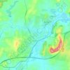
Carte topographique Mount Terrace

Cliquez sur la carte pour afficher l’altitude.

À propos de cette carte

Nom : Carte topographique Mount Terrace, altitude, relief.

Lieu : Mount Terrace, New South Wales, Australia (-31.34056 148.93049 -31.34046 148.93059)

Altitude moyenne : 613 m

Altitude minimum : 481 m

Altitude maximum : 867 m

Autres cartes topographiques

Cliquez sur une carte pour visualiser sa topographie, son altitude et son relief.
Sydney

Australia > New South Wales

Sydney's topography is characterized by a diverse landscape that seamlessly blends coastal features with inland plateaus. The city is divided into two primary regions: the relatively flat Cumberland Plain to the south and west of Sydney Harbour, and the elevated Hornsby Plateau to the north. The Cumberland…

Altitude moyenne : 51 m
Penrith

Australia > New South Wales > Sydney > Penrith

Penrith is a city in New South Wales, Australia, located in Greater Western Sydney, 55 kilometres (31 mi) west of the Sydney central business district on the banks of the Nepean River, on the outskirts of the Cumberland Plain. Its elevation is 32 metres (105 ft).

Altitude moyenne : 34 m
Sydney

Australia > New South Wales > Sydney

Altitude moyenne : 23 m

Newcastle

Australia > New South Wales > Newcastle

Altitude moyenne : 5 m

Camden Council

Australia > New South Wales > Sydney

Altitude moyenne : 90 m

Barrington Tops National Park

Australia > New South Wales

The climate varies from temperate on the lower altitudes to subalpine at highest elevations. A record low of −17 °C (1 °F) has been registered at 1,500 m (4,900 ft) above mean sea level. Rainfalls fluctuate between 750 millimetres (30 in) in the northwest to more than 2,000 mm (79 in) in the southeast.

Altitude moyenne : 736 m
St Ives

Australia > New South Wales > Sydney

Altitude moyenne : 125 m

St Georges Basin

Australia > New South Wales

Altitude moyenne : 18 m

Barrington Tops

Australia > New South Wales

Altitude moyenne : 1’107 m

Kenthurst

Australia > New South Wales > Sydney

Altitude moyenne : 100 m

Blue Mountains

Australia > New South Wales

A sandstone plateau dominated by a landscape of endless eucalyptus forests, the Blue Mountains are located at the top of a 470-million-year-old quartzite. In the Permian period, a shallow sea covered the region, when rivers brought shales, siltstones and mudstones. Then during the Mesozoic period, rivers…

Altitude moyenne : 566 m
Glen Innes

Australia > New South Wales

Altitude moyenne : 1’083 m

Ocean Shores

Australia > New South Wales

Altitude moyenne : 12 m

Hornsby

Australia > New South Wales > Sydney

Altitude moyenne : 160 m

Lake Bathurst

Australia > New South Wales

Altitude moyenne : 742 m

Tenterfield

Australia > New South Wales

Altitude moyenne : 891 m

Kurri Kurri

Australia > New South Wales

Altitude moyenne : 31 m

Moruya

Australia > New South Wales

Altitude moyenne : 37 m

Katoomba

Australia > New South Wales

Altitude moyenne : 904 m

Leura

Australia > New South Wales

Leura's elevation of 985 metres (3,232 ft) AHD  leads to occasional snowfall in winter and a climate that reflects all four seasons distinctly.

Altitude moyenne : 880 m

Norah Head

Australia > New South Wales

Altitude moyenne : 9 m

Ourimbah

Australia > New South Wales

Altitude moyenne : 84 m

Wauchope

Australia > New South Wales

Altitude moyenne : 32 m

North Rothbury

Australia > New South Wales

Altitude moyenne : 66 m

Medowie

Australia > New South Wales

Altitude moyenne : 16 m

Stanwell Park

Australia > New South Wales

Altitude moyenne : 96 m

Bega

Australia > New South Wales

Altitude moyenne : 21 m

Audley

Australia > New South Wales

Altitude moyenne : 91 m

Fairlight

Australia > New South Wales > Sydney

Altitude moyenne : 23 m

Cooma

Australia > New South Wales

Altitude moyenne : 869 m

Tenterden

Australia > New South Wales

Altitude moyenne : 1’092 m

Tumbarumba

Australia > New South Wales

Another site approximately 25 kilometres (16 mi) to the north-west of Tumbarumba operated from 1938 to 1997, at the Carabost Forest Headquarters. There is a remarkable warming trend to be observed between the two sites; particularly in the winter months, where Tumbarumba Post Office averages 10.8 °C (51.4…

Altitude moyenne : 774 m

Adaminaby

Australia > New South Wales

Another site 20 km to the north (Yaouk, since 1969) records significantly greater rainfall due to its higher elevation and proximity to the dividing range. This site is most representative of the areas situated on and around Lake Eucumbene. Rainfall total and pattern here approach those of Khancoban and very…

Altitude moyenne : 1’174 m
Millfield

Australia > New South Wales

Altitude moyenne : 190 m

Possum Creek

Australia > New South Wales

Altitude moyenne : 78 m

Forbes Shire Council

Australia > New South Wales

Altitude moyenne : 291 m

Glebe

Australia > New South Wales > Sydney

Altitude moyenne : 18 m

Asquith

Australia > New South Wales

Altitude moyenne : 168 m

Illawarra

Australia > New South Wales

Altitude moyenne : 234 m

Northern Beaches

Australia > New South Wales > Sydney

Altitude moyenne : 67 m

McMahons Point

Australia > New South Wales > Sydney

Altitude moyenne : 23 m

Central Coast Council

Australia > New South Wales

Altitude moyenne : 103 m

San Remo

Australia > New South Wales

Altitude moyenne : 16 m

Parramatta

Australia > New South Wales

Altitude moyenne : 22 m

Armidale

Australia > New South Wales

Altitude moyenne : 1’036 m

Mosman

Australia > New South Wales > Sydney

Altitude moyenne : 29 m

Port Macquarie

Australia > New South Wales

Altitude moyenne : 5 m

Byron Bay

Australia > New South Wales

Byron Bay, located in northeastern New South Wales, Australia, is characterized by diverse topography shaped by its geological history. The town is part of the erosion caldera of the ancient Tweed Volcano, which erupted approximately 23 million years ago, resulting in the rich volcanic soils that define the…

Altitude moyenne : 7 m
Berowra

Australia > New South Wales > Sydney

Berowra is located 44 kilometres north of the Sydney CBD and lies at an altitude of 215 metres. Surrounded by bushland, it borders the national parks of both the Berowra Valley and Ku-ring-gai Chase.

Altitude moyenne : 144 m

Nimbin

Australia > New South Wales

Altitude moyenne : 235 m

Strathfield

Australia > New South Wales > Sydney

Altitude moyenne : 26 m

Federal

Australia > New South Wales

Altitude moyenne : 102 m

Khancoban

Australia > New South Wales

Altitude moyenne : 642 m

Sunny Corner

Australia > New South Wales

Altitude moyenne : 1’119 m

McGraths Hill

Australia > New South Wales > Sydney

Altitude moyenne : 10 m

Woolloomooloo

Australia > New South Wales > Sydney

Altitude moyenne : 26 m

Turon River

Australia > New South Wales

Altitude moyenne : 817 m

Waitara

Australia > New South Wales > Sydney

Altitude moyenne : 172 m

Griffith

Australia > New South Wales

Altitude moyenne : 131 m

Girvan

Australia > New South Wales

Altitude moyenne : 99 m

Cooranbong

Australia > New South Wales

Altitude moyenne : 72 m

Nowra

Australia > New South Wales

Altitude moyenne : 21 m

Botany Bay

Australia > New South Wales > Sydney

Altitude moyenne : 8 m

Blackheath

Australia > New South Wales

Blackheath (postcode: 2785) is an Australian town located near the highest point of the Blue Mountains, between Katoomba and Mount Victoria in New South Wales. The town's altitude is about 1,065 metres (3,494 ft) AHD  and it is located about 120 kilometres (75 mi) west north-west of Sydney, 11 kilometres…

Altitude moyenne : 893 m
Moss Vale

Australia > New South Wales

Altitude moyenne : 673 m

Pittwater

Australia > New South Wales

Altitude moyenne : 45 m

Normanhurst

Australia > New South Wales

Altitude moyenne : 165 m

Coogee

Australia > New South Wales

Altitude moyenne : 35 m

Perisher Valley

Australia > New South Wales

Altitude moyenne : 1’704 m

Epping

Australia > New South Wales > Sydney

Altitude moyenne : 96 m

Michelago

Australia > New South Wales

Michelago is situated in a valley between two mountain ranges, the Tinderry Range to the East and the Clear Range to the west. The Tinderry Road crosses the Tinderry range from Michelago, leading ultimately to the 1950s silver mining settlement Captains Flat. The highest peaks in the picturesque Tinderry Range…

Altitude moyenne : 958 m
Ryde

Australia > New South Wales > Sydney

Altitude moyenne : 52 m

Wilberforce

Australia > New South Wales

Altitude moyenne : 24 m

Chillingham

Australia > New South Wales

Altitude moyenne : 94 m

Orange

Australia > New South Wales

Orange is a city in the Central Tablelands region of New South Wales, Australia. It is 254 km (158 mi) west of the state capital, Sydney [206 km (128 mi) on a great circle], at an altitude of 862 metres (2,828 ft). Orange had an estimated urban population of 40,493 as of June 2018 making the city a significant…

Altitude moyenne : 852 m
Yamba

Australia > New South Wales

Altitude moyenne : 2 m

Bonville

Australia > New South Wales

Altitude moyenne : 60 m

Inner West

Australia > New South Wales > Sydney

Altitude moyenne : 19 m

Glenworth Valley

Australia > New South Wales

Altitude moyenne : 115 m

Murrurundi

Australia > New South Wales

Altitude moyenne : 641 m

Nurenmerenmong

Australia > New South Wales

Altitude moyenne : 992 m

Isabella

Australia > New South Wales

Altitude moyenne : 1’070 m

Merotherie

Australia > New South Wales

Altitude moyenne : 463 m

South Durras

Australia > New South Wales

Altitude moyenne : 32 m

Barwon River

Australia > New South Wales

Altitude moyenne : 150 m

Hurstville

Australia > New South Wales > Sydney

Altitude moyenne : 50 m

Campbelltown

Australia > New South Wales

Altitude moyenne : 96 m

Goulburn

Australia > New South Wales

Owing to its elevation, Goulburn has an oceanic climate (Cfb) with warm summers and cool winters; with a high diurnal range. Its climate is variable much of the year, though generally dry with maximum temperatures ranging from 11.8 °C (53.2 °F) in July to 28.3 °C (82.9 °F) in January. Rainfall is…

Altitude moyenne : 666 m

Équipez-vous pour votre prochaine aventure :

🧳Sacs de transport outdoor - Organisation du matériel
🧤Gants de randonnée - Gants chauds ou respirants pour conditions changeantes
🥤Paille filtrante / Gourde - Buvez l'eau des torrents en toute sécurité grâce à la filtration
☕Tasse de randonnée - Légère et robuste pour votre pause café face au panorama
⌚Montre Altimètre - Suivez votre ascension et les changements de pression barométrique en direct

En tant que Partenaire Amazon, ce site perçoit une commission sur les achats éligibles sans surcoût pour vous.