
Carte topographique Mackey Island
Cliquez sur la carte pour afficher l’altitude.
À propos de cette carte
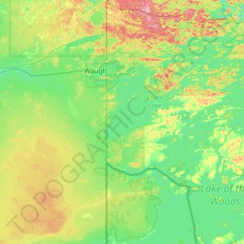
Nom : Carte topographique Mackey Island, altitude, relief.
Altitude moyenne : 336 m
Altitude minimum : 312 m
Altitude maximum : 415 m
Autres cartes topographiques
Cliquez sur une carte pour visualiser sa topographie, son altitude et son relief.
Burditt Lake
Canada > Ontario > Kenora District > Unorganized Kenora District
Altitude moyenne : 367 m
Dogtooth Lake
Canada > Ontario > Kenora District > Unorganized Kenora District
Altitude moyenne : 361 m
lac Seul
Canada > Ontario > Kenora District > Unorganized Kenora District
Lac Seul is a large, crescent shaped reservoir in Kenora District, northwestern Ontario, Canada. It is approximately 241 km (150 mi) long. It has a maximum (regulated) depth of 47.2 m, with a surface elevation of 357 m above sea level. Its level is raised in the summer and then drawn down in the winter months…
Altitude moyenne : 374 m
Granite Lake
Canada > Ontario > Kenora District > Unorganized Kenora District
Altitude moyenne : 355 m
McIntosh Lake
Canada > Ontario > Kenora District > Unorganized Kenora District
Altitude moyenne : 395 m
Big Island Lake
Canada > Ontario > Kenora District > Unorganized Kenora District
Altitude moyenne : 430 m
Maynard Lake
Canada > Ontario > Kenora District > Unorganized Kenora District
Altitude moyenne : 337 m
Affleck Lake
Canada > Ontario > Kenora District > Unorganized Kenora District
Altitude moyenne : 421 m
Grindstone Lake
Canada > Ontario > Kenora District > Unorganized Kenora District
Altitude moyenne : 371 m
Slate Islands
Canada > Ontario > Kenora District > Unorganized Kenora District
Altitude moyenne : 322 m
MacDowell Lake
Canada > Ontario > Kenora District > Unorganized Kenora District
Altitude moyenne : 386 m
Lake Charles
Canada > Ontario > Kenora District > Unorganized Kenora District
Altitude moyenne : 346 m
Fiddler Lake
Canada > Ontario > Kenora District > Unorganized Kenora District
Altitude moyenne : 293 m
Cardinal (Lac) Lake
Canada > Ontario > Kenora District > Unorganized Kenora District
Altitude moyenne : 392 m
Big Canon Lake
Canada > Ontario > Kenora District > Unorganized Kenora District
Altitude moyenne : 363 m
Minnitaki Lake
Canada > Ontario > Kenora District > Unorganized Kenora District
Altitude moyenne : 386 m
Nine Mile Lake
Canada > Ontario > Kenora District > Unorganized Kenora District
Altitude moyenne : 413 m
Carroll Lake
Canada > Ontario > Kenora District > Unorganized Kenora District
Altitude moyenne : 338 m
Chisholm Island
Canada > Ontario > Kenora District > Unorganized Kenora District
Altitude moyenne : 323 m
Muskeg River
Canada > Ontario > Kenora District > Unorganized Kenora District
Altitude moyenne : 357 m
Whitefish Lake
Canada > Ontario > Kenora District > Unorganized Kenora District
Altitude moyenne : 380 m
Dingwall Island
Canada > Ontario > Kenora District > Unorganized Kenora District
Altitude moyenne : 325 m
Confederation Lake
Canada > Ontario > Kenora District > Unorganized Kenora District
Altitude moyenne : 414 m
Fredart Lake
Canada > Ontario > Kenora District > Unorganized Kenora District
Altitude moyenne : 409 m
Two Island Lake
Canada > Ontario > Kenora District > Unorganized Kenora District
Altitude moyenne : 361 m
Spadina Lake
Canada > Ontario > Kenora District > Unorganized Kenora District
Altitude moyenne : 376 m
Blackstone Lake
Canada > Ontario > Kenora District > Unorganized Kenora District
Altitude moyenne : 382 m
Winnipeg River
Canada > Ontario > Kenora District > Unorganized Kenora District
Altitude moyenne : 317 m
Warwick Lake
Canada > Ontario > Kenora District > Unorganized Kenora District
Altitude moyenne : 341 m
Bertrand Lake
Canada > Ontario > Kenora District > Unorganized Kenora District
Altitude moyenne : 414 m
Muskeg River
Canada > Ontario > Kenora District > Unorganized Kenora District
Altitude moyenne : 363 m
Snelgrove Lake
Canada > Ontario > Kenora District > Unorganized Kenora District
Altitude moyenne : 408 m
Tablerock Lake
Canada > Ontario > Kenora District > Unorganized Kenora District
Altitude moyenne : 384 m
Wabaskang Lake
Canada > Ontario > Kenora District > Unorganized Kenora District
Altitude moyenne : 375 m
Minnitaki Lake
Canada > Ontario > Kenora District > Unorganized Kenora District
Altitude moyenne : 386 m
Kukukus Lake
Canada > Ontario > Kenora District > Unorganized Kenora District
Altitude moyenne : 405 m
Antenna Lake
Canada > Ontario > Kenora District > Unorganized Kenora District
Altitude moyenne : 393 m
Little Boulder Lake
Canada > Ontario > Kenora District > Unorganized Kenora District
Altitude moyenne : 359 m
Cluster Lakes
Canada > Ontario > Kenora District > Unorganized Kenora District
Altitude moyenne : 443 m