Géolocaliser

Carte topographique Windsor

Cliquez sur la carte pour afficher l’altitude.

À propos de cette carte

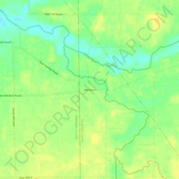
Nom : Carte topographique Windsor, altitude, relief.

Lieu : Windsor, Randolph County, Indiana, 47368, United States (40.13449 -85.23275 40.17449 -85.19275)

Altitude moyenne : 312 m

Altitude minimum : 298 m

Altitude maximum : 321 m

Autres cartes topographiques

Cliquez sur une carte pour visualiser sa topographie, son altitude et son relief.

Farmland

United States > Indiana > Randolph County

Altitude moyenne : 318 m

Lynn

United States > Indiana > Randolph County

Altitude moyenne : 356 m

Parker City

United States > Indiana > Randolph County

According to the 2010 census, Parker City has a total area of 0.57 square miles (1.48 km2), all land. It is located at an elevation of 1025 feet.

Altitude moyenne : 312 m

Winchester

United States > Indiana > Randolph County

Altitude moyenne : 335 m

Modoc

United States > Indiana > Randolph County

Altitude moyenne : 355 m

Ridgeville

United States > Indiana > Randolph County

A post office called Ridgeville has been in operation since 1851. The town was named for its lofty elevation. Joab Ward, an old Settler to Ridgeville since 1819, originally laid out the village of Ridgeville, Randolph County, Indiana in 1854.

Altitude moyenne : 306 m

Saratoga

United States > Indiana > Randolph County

Altitude moyenne : 322 m

Losantville

United States > Indiana > Randolph County

Altitude moyenne : 346 m

Équipez-vous pour votre prochaine aventure :

🧤Chaufferettes - Un confort indispensable pour les journées de grand froid
🧺Couverture de survie - Équipement de sécurité vital pour prévenir l'hypothermie
🌍Globes terrestres - Visualisation géographique
🧥Lessive pour vêtements techniques - Préservez l'imperméabilité de vos vestes haut de gamme
🍼Gourde inox isotherme - Conserve le café chaud ou l'eau fraîche pendant des heures

En tant que Partenaire Amazon, ce site perçoit une commission sur les achats éligibles sans surcoût pour vous.