Carte topographique Modoc
Carte interactive
Cliquez sur la carte pour afficher l’altitude.
À propos de cette carte
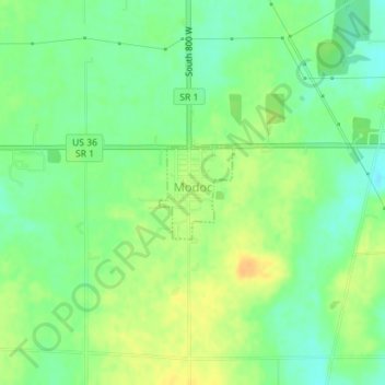
Nom : Carte topographique Modoc, altitude, relief.
Lieu : Modoc, Randolph County, Indiana, United States (40.04164 -85.12944 40.04817 -85.12272)
Altitude moyenne : 355 m
Altitude minimum : 341 m
Altitude maximum : 371 m
Autres cartes topographiques
Cliquez sur une carte pour visualiser sa topographie, son altitude et son relief.
Union City
United States > Indiana > Randolph County
Union City, Randolph County, Indiana, United States
Altitude moyenne : 333 m
Parker City
United States > Indiana > Randolph County
Parker City, Randolph County, Indiana, 47368, United States
Altitude moyenne : 312 m
Windsor
United States > Indiana > Randolph County
Windsor, Randolph County, Indiana, 47368, United States
Altitude moyenne : 312 m
Farmland
United States > Indiana > Randolph County
Farmland, Randolph County, Indiana, United States
Altitude moyenne : 318 m
Lynn
United States > Indiana > Randolph County
Lynn, Randolph County, Indiana, United States
Altitude moyenne : 356 m
Winchester
United States > Indiana > Randolph County
Winchester, Randolph County, Indiana, 47494, United States
Altitude moyenne : 335 m