
Carte topographique Cowiche Creek
Carte interactive
Cliquez sur la carte pour afficher l’altitude.
À propos de cette carte
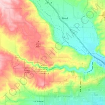
Nom : Carte topographique Cowiche Creek, altitude, relief.
Altitude moyenne : 449 m
Altitude minimum : 349 m
Altitude maximum : 576 m
Autres cartes topographiques
Cliquez sur une carte pour visualiser sa topographie, son altitude et son relief.
Yakima Sportsman State Park
United States > Washington > Yakima
Yakima Sportsman State Park, Yakima, Washington, United States
Altitude moyenne : 314 m
Buchanan Lake
United States > Washington > Yakima
Buchanan Lake, Yakima, Washington, United States
Altitude moyenne : 313 m