
Carte topographique Buchanan Lake
Carte interactive
Cliquez sur la carte pour afficher l’altitude.
À propos de cette carte
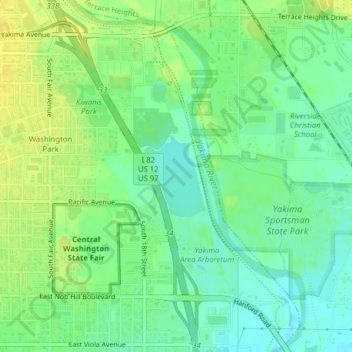
Nom : Carte topographique Buchanan Lake, altitude, relief.
Lieu : Buchanan Lake, Yakima, Washington, United States (46.59116 -120.47770 46.59745 -120.47083)
Altitude moyenne : 313 m
Altitude minimum : 303 m
Altitude maximum : 323 m
Autres cartes topographiques
Cliquez sur une carte pour visualiser sa topographie, son altitude et son relief.
Yakima Sportsman State Park
United States > Washington > Yakima
Yakima Sportsman State Park, Yakima, Washington, United States
Altitude moyenne : 314 m
Cowiche Creek
United States > Washington > Yakima
Cowiche Creek, Yakima, Yakima County, Washington, 98902, United States
Altitude moyenne : 449 m