
Carte topographique ولسوالی ورسج
Carte interactive
Cliquez sur la carte pour afficher l’altitude.
À propos de cette carte
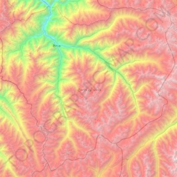
Nom : Carte topographique ولسوالی ورسج, altitude, relief.
Lieu : ولسوالی ورسج, Wilaya Tachar, Afghanistan (35.78272 69.76583 36.32931 70.49268)
Altitude moyenne : 3’935 m
Altitude minimum : 1’548 m
Altitude maximum : 5’979 m
Autres cartes topographiques
Cliquez sur une carte pour visualiser sa topographie, son altitude et son relief.
ولسوالی اشکمش
ولسوالی اشکمش, Wilaya Tachar, Afghanistan
Altitude moyenne : 1’693 m
ولسوالی چاهآب
ولسوالی چاهآب, Wilaya Tachar, Afghanistan
Altitude moyenne : 1’269 m