
Carte topographique ولسوالی اشکمش
Carte interactive
Cliquez sur la carte pour afficher l’altitude.
À propos de cette carte
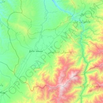
Nom : Carte topographique ولسوالی اشکمش, altitude, relief.
Lieu : ولسوالی اشکمش, Wilaya Tachar, Afghanistan (36.22818 69.17553 36.53573 69.67298)
Altitude moyenne : 1’693 m
Altitude minimum : 805 m
Altitude maximum : 4’277 m
Autres cartes topographiques
Cliquez sur une carte pour visualiser sa topographie, son altitude et son relief.
ولسوالی چاهآب
ولسوالی چاهآب, Wilaya Tachar, Afghanistan
Altitude moyenne : 1’269 m
ولسوالی ورسج
ولسوالی ورسج, Wilaya Tachar, Afghanistan
Altitude moyenne : 3’935 m