
Carte topographique Gronant Dunes
Carte interactive
Cliquez sur la carte pour afficher l’altitude.
À propos de cette carte
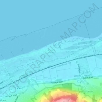
Nom : Carte topographique Gronant Dunes, altitude, relief.
Lieu : Gronant Dunes, Prestatyn, Denbighshire, Wales, United Kingdom (53.34442 -3.40156 53.35069 -3.35857)
Altitude moyenne : 11 m
Altitude minimum : 0 m
Altitude maximum : 135 m
Autres cartes topographiques
Cliquez sur une carte pour visualiser sa topographie, son altitude et son relief.
Parc Pendre
United Kingdom > Wales > Denbighshire > Prestatyn
Parc Pendre, Prestatyn, Denbighshire, Wales, United Kingdom
Altitude moyenne : 53 m