Carte topographique Green Valley
Cliquez sur la carte pour afficher l’altitude.
À propos de cette carte

Nom : Carte topographique Green Valley, altitude, relief.
Altitude moyenne : 934 m
Altitude minimum : 915 m
Altitude maximum : 978 m
Autres cartes topographiques
Cliquez sur une carte pour visualiser sa topographie, son altitude et son relief.
Rapid City
United States > South Dakota > Pennington County
Rapid City is located at 44°04′34″N 103°13′42″W / 44.076188°N 103.228299°W / 44.076188; -103.228299. The downtown elevation of Rapid City is 3,202 feet (976 m). Rapid City is located in the shadow of Black Elk Peak, which at 7,242 feet (2,207 m), is the highest point east of the Rocky Mountains.
Altitude moyenne : 1’067 m
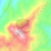
Black Hills
United States > South Dakota > Pennington County
The Black Hills is an isolated mountain range rising from the Great Plains of North America in western South Dakota and extending into Wyoming, United States. Black Elk Peak, which rises to 7,242 feet (2,207 m), is the range's highest summit. The name of the range in Lakota is Pahá Sápa. It encompasses the…
Altitude moyenne : 1’894 m
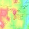
Mount Rushmore
United States > South Dakota > Pennington County
Mount Rushmore National Memorial is centered on a colossal sculpture carved into the granite face of Mount Rushmore (Lakota: Tȟuŋkášila Šákpe, or Six Grandfathers) in the Black Hills near Keystone, South Dakota. Sculptor Gutzon Borglum created the sculpture's design and oversaw the project's execution…
Altitude moyenne : 1’562 m
Rapid City
United States > South Dakota > Pennington County
Rapid City is located at 44°04′34″N 103°13′42″W / 44.076188°N 103.228299°W / 44.076188; -103.228299. The downtown elevation of Rapid City is 3,202 feet (976 m). Rapid City is located in the shadow of Black Elk Peak, which at 7,242 feet (2,207 m), is the highest point east of the Rocky Mountains.
Altitude moyenne : 1’068 m
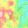
Mount Rushmore National Memorial
United States > South Dakota > Pennington County
The Mount Rushmore National Memorial is a national memorial centered on a colossal sculpture carved into the granite face of Mount Rushmore (Lakota: Tȟuŋkášila Šákpe, or Six Grandfathers) in the Black Hills near Keystone, South Dakota, United States. Sculptor Gutzon Borglum designed the sculpture, called…
Altitude moyenne : 1’528 m
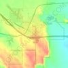
Black Hills
United States > South Dakota > Pennington County
The Black Hills is an isolated mountain range rising from the Great Plains of North America in western South Dakota and extending into Wyoming, United States. Black Elk Peak, which rises to 7,242 feet (2,207 m), is the range's highest summit. The name of the range in Lakota is Pahá Sápa. It encompasses the…
Altitude moyenne : 1’894 m
Pactola Reservoir Recreation Area
United States > South Dakota > Pennington County
Altitude moyenne : 1’491 m
Johnson Siding
United States > South Dakota > Pennington County > Johnson Siding
Altitude moyenne : 1’408 m
Black Elk Peak
United States > South Dakota > Pennington County
In September 2016, a team of professional surveyors obtained precise GNSS data over the course of two days and found the highest natural rock to be at 7,231.32 feet (2,204.11 m) NAVD88 and a nearby secondary peak located approximately 300 feet south of the lookout tower and unofficially named "McGillicuddy's…
Altitude moyenne : 1’923 m

Black Hills
United States > South Dakota > Pennington County
The Black Hills are an outlying subrange of the greater Rocky Mountain system rising from the Great Plains of North America in western South Dakota and eastern Wyoming, United States. Black Elk Peak, which rises to 7,242 feet (2,207 m), is the range's highest summit. The name of the range in Lakota is Pahá…
Altitude moyenne : 1’894 m

Rapid City
United States > South Dakota > Pennington County
Rapid City has a transitional climate between a semi-arid climate (Köppen: BSk) and a hot-summer humid continental climate (Köppen: Dwa), and is part of USDA Hardiness zone 5b. Its location makes its climate unlike both the higher elevations of the Black Hills to the west and the Great Plains to the east. It…
Altitude moyenne : 1’096 m
Mount Rushmore National Memorial
United States > South Dakota > Pennington County
The Mount Rushmore National Memorial is a national memorial centered on a colossal sculpture carved into the granite face of Mount Rushmore (Lakota: Tȟuŋkášila Šákpe, or Six Grandfathers) in the Black Hills near Keystone, South Dakota, United States. The sculptor, Gutzon Borglum, named it the Shrine of…
Altitude moyenne : 1’528 m
Mount Rushmore National Memorial
United States > South Dakota > Pennington County
Mount Rushmore National Memorial is a national memorial centered on a colossal sculpture carved into the granite face of Mount Rushmore (Lakota: Tȟuŋkášila Šákpe, or Six Grandfathers) in the Black Hills near Keystone, South Dakota, United States. Sculptor Gutzon Borglum created the sculpture's design and…
Altitude moyenne : 1’528 m
Rapid City
United States > South Dakota > Pennington County
Rapid City is located at 44°04′34″N 103°13′42″W / 44.076188°N 103.228299°W / 44.076188; -103.228299. The downtown elevation of Rapid City is 3,202 feet (976 m). Rapid City is located in the shadow of Black Elk Peak, which at 7,242 feet (2,207 m), is the highest point east of the Rocky Mountains.
Altitude moyenne : 1’068 m
Black Hills
United States > South Dakota > Pennington County
The Black Hills is an isolated mountain range rising from the Great Plains of North America in western South Dakota and extending into Wyoming, United States. Black Elk Peak, which rises to 7,242 feet (2,207 m), is the range's highest summit. The name of the range in Lakota is Pahá Sápa. It encompasses the…
Altitude moyenne : 1’894 m