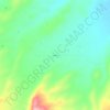
Carte topographique Missoula County
Cliquez sur la carte pour afficher l’altitude.
À propos de cette carte

Nom : Carte topographique Missoula County, altitude, relief.
Lieu : Missoula County, Montana, United States, Cottonwood Lakes (47.16291 -113.35821 47.16815 -113.34724)
Altitude moyenne : 1’673 m
Altitude minimum : 1’439 m
Altitude maximum : 1’965 m
Autres cartes topographiques
Cliquez sur une carte pour visualiser sa topographie, son altitude et son relief.


Bozeman
United States > Montana > Gallatin County
Bozeman is located at an elevation of 4,820 feet (1,470 m). The Bridger Mountains are to the north-northeast, the Tobacco Root Mountains to the west-southwest, the Big Belt Mountains and Horseshoe Hills to the northwest, the Hyalite Peaks of the northern Gallatin Range to the south and the Spanish Peaks of the…
Altitude moyenne : 1’679 m















Kalispell
United States > Montana > Flathead County > Kalispell
Kalispell is located at 48°11′52″N 114°18′58″W / 48.19778°N 114.31611°W / 48.19778; -114.31611 (48.197801, −114.316068), at an elevation of 2,956 feet (901 m).
Altitude moyenne : 1’055 m
Dillon
United States > Montana > Beaverhead County > Dillon
Dillon is located at 45°12′57″N 112°38′3″W / 45.21583°N 112.63417°W / 45.21583; -112.63417 (45.215735, -112.634055), approximately 40 miles (64 km) east of the Continental Divide. It lies at an elevation of 5,102 feet (1,555 m).
Altitude moyenne : 1’592 m
Olive
United States > Montana > Powder River County > Olive
Olive (also Rocky Point) is an unincorporated community in north central Powder River County, Montana, United States. It lies along Highway 59 northwest of the town of Broadus, the county seat of Powder River County. Its elevation is 3,232 feet (985 m).
Altitude moyenne : 1’001 m
Big Sky Canyon Village
United States > Montana > Gallatin County > Big Sky Canyon Village
Altitude moyenne : 1’994 m

Thompson Falls
United States > Montana > Sanders County > Thompson Falls
Thompson Falls is located at 47°35′48″N 115°20′37″W / 47.59667°N 115.34361°W / 47.59667; -115.34361 (47.596587, -115.343730) in the Clark Fork Valley at an elevation of 2,419 feet (737 m).
Altitude moyenne : 897 m




Cook Lake
United States > Montana > Custer County > Miles City > Smiths Trailer Court
Altitude moyenne : 721 m












Little Granulated Mountain
United States > Montana > Silver Bow County > Butte
Altitude moyenne : 2’557 m
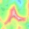

Freezout Lake Wildlife Management Area
United States > Montana > Teton County
Altitude moyenne : 1’157 m
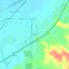
Carbon Hill Trailer Court
United States > Montana > Custer County > Miles City
Altitude moyenne : 732 m
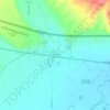
Rice Motel and Trailer Court
United States > Montana > Jefferson County > Whitehall
Altitude moyenne : 1’338 m