
Carte topographique Sessa Orchid Sanctuary
Carte interactive
Cliquez sur la carte pour afficher l’altitude.
À propos de cette carte
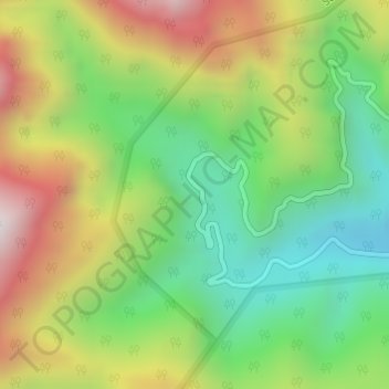
Nom : Carte topographique Sessa Orchid Sanctuary, altitude, relief.
Altitude moyenne : 1’414 m
Altitude minimum : 968 m
Altitude maximum : 2’044 m
Sessa sanctuary is drained by the Tippi Naala (Tippi river), which joins the Kameng river at Tippi village on the Bhalukpong-Bomdila highway. Topographic map
Autres cartes topographiques
Cliquez sur une carte pour visualiser sa topographie, son altitude et son relief.
Bhalukpong
India > Arunachal Pradesh > Bhalukpong EAC
Bhalukpong, Bhalukpong EAC, West Kameng District, Arunachal Pradesh, 790114, India
Altitude moyenne : 243 m
Eagle Nest WLS
India > Arunachal Pradesh > Bhalukpong EAC
Eagle Nest WLS, Bhalukpong EAC, West Kameng district, Arunachal Pradesh, India
Altitude moyenne : 1’680 m