

Carte topographique Windermere
Cliquez sur la carte pour afficher l’altitude.
Windermere
There is debate as to whether the stretch of water between Newby Bridge and Lakeside at the southern end of the lake should be considered part of Windermere, or a navigable stretch of the River Leven. This affects the stated length of the lake, which is 11.23 miles (18.07 km) long if measured from the bridge at Newby Bridge,[10] or 10.5 miles (16.9 km) if measured from Lakeside[citation needed]. The lake varies in width up to a maximum of 1 mile (1.6 km), and covers an area of 14.73 km2 (5.69 sq mi).[10] With a maximum depth of 66.7 m (219 ft) and an elevation above sea level of 39 m (128 ft), the lowest point of the lake bed is well below sea level.[10]
À propos de cette carte
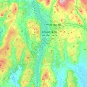
Nom : Carte topographique Windermere, altitude, relief.
Altitude moyenne : 132 m
Altitude minimum : 3 m
Altitude maximum : 478 m
Autres cartes topographiques
Cliquez sur une carte pour visualiser sa topographie, son altitude et son relief.
Storrs
United Kingdom > England > Cumbria > South Lakeland > Bowness-on-Windermere
Altitude moyenne : 93 m