Géolocaliser

Cartes topographiques Inverness

Cliquez sur une carte pour visualiser sa topographie, son altitude et son relief.

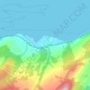
Bunchrew

United Kingdom > Scotland > Highland > Inverness

Altitude moyenne : 66 m

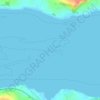
Beauly Firth

United Kingdom > Scotland > Highland > Inverness

Altitude moyenne : 4 m

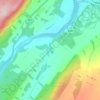
Scaniport

United Kingdom > Scotland > Highland > Inverness

Altitude moyenne : 85 m

Loch Ashie

United Kingdom > Scotland > Highland > Inverness

Altitude moyenne : 228 m

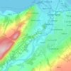
River Ness

United Kingdom > Scotland > Highland > Inverness

Altitude moyenne : 69 m

Culloden

United Kingdom > Scotland > Highland > Inverness

Altitude moyenne : 51 m

Équipez-vous pour votre prochaine aventure :

🧊Gourdes isothermes - Hydratation chaude ou froide en randonnée
🧯Trousses de premiers secours - Sécurité et soins en randonnée
👖Pantalon de marche modulable - Transformable en short pour s'adapter aux variations météo
🌂Parapluie de randonnée - Ultra-robuste pour marcher sous la pluie sans étouffer dans une veste
🧴Crèmes solaires haute protection - Protection UV renforcée

En tant que Partenaire Amazon, ce site perçoit une commission sur les achats éligibles sans surcoût pour vous.