Géolocaliser

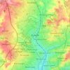
Cartes topographiques Nottingham

Cliquez sur une carte pour visualiser sa topographie, son altitude et son relief.

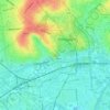
Wollaton Park

United Kingdom > England > Nottingham > Wollaton

Altitude moyenne : 44 m

Highfields Park

United Kingdom > England > Nottingham

Altitude moyenne : 35 m

Brewhouse Yard

United Kingdom > England > Nottingham

Altitude moyenne : 40 m

Nottingham Castle

United Kingdom > England > Nottingham

Altitude moyenne : 41 m

Castle Marina

United Kingdom > England > Nottingham

Altitude moyenne : 36 m

Scaffell Way Park

United Kingdom > England > Nottingham

Altitude moyenne : 43 m

Wilford

United Kingdom > England > Nottingham

Altitude moyenne : 28 m

Berridge Ward

United Kingdom > England > Nottingham > Arnold

Altitude moyenne : 56 m

The Bay of Biscay

United Kingdom > England > Nottingham

Altitude moyenne : 46 m

Arboretum

United Kingdom > England > Nottingham

Altitude moyenne : 57 m

Bulwell

United Kingdom > England > Nottingham

Altitude moyenne : 84 m

Wollaton

United Kingdom > England > Nottingham

Altitude moyenne : 58 m

À propos de ce lieu

 •

Équipez-vous pour votre prochaine aventure :

🗺️Cartes topographiques papier - Cartes détaillées pour randonnée, orientation et lecture du relief
🛏️Sacs de couchage - Sacs de couchage adaptés à toutes saisons
🎿Housse de transport skis - Protégez votre matériel lors de vos déplacements en train ou voiture
🧗Gants d’escalade - Protection et grip
🧥Lessive pour vêtements techniques - Préservez l'imperméabilité de vos vestes haut de gamme

En tant que Partenaire Amazon, ce site perçoit une commission sur les achats éligibles sans surcoût pour vous.