Géolocaliser

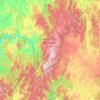
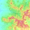
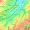
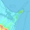
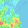
Carte topographique Cocumbark

Cliquez sur la carte pour afficher l’altitude.

À propos de cette carte

Nom : Carte topographique Cocumbark, altitude, relief.

Lieu : Cocumbark, Dyers Crossing, Mid-Coast Council, New South Wales, 2429, Australia (-32.11833 152.24778 -32.07833 152.28778)

Altitude moyenne : 52 m

Altitude minimum : 21 m

Altitude maximum : 181 m

Autres cartes topographiques

Cliquez sur une carte pour visualiser sa topographie, son altitude et son relief.
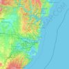
Sydney

Australia > New South Wales

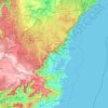
Sydney's topography is characterized by a diverse landscape that seamlessly blends coastal features with inland plateaus. The city is divided into two primary regions: the relatively flat Cumberland Plain to the south and west of Sydney Harbour, and the elevated Hornsby Plateau to the north. The Cumberland…

Altitude moyenne : 51 m
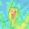
Sydney

Australia > New South Wales > Sydney

Altitude moyenne : 23 m

Penrith

Australia > New South Wales > Sydney > Penrith

Penrith is a city in New South Wales, Australia, located in Greater Western Sydney, 55 kilometres (31 mi) west of the Sydney central business district on the banks of the Nepean River, on the outskirts of the Cumberland Plain. Its elevation is 32 metres (105 ft).

Altitude moyenne : 34 m

Barrington Tops National Park

Australia > New South Wales

The climate varies from temperate on the lower altitudes to subalpine at highest elevations. A record low of −17 °C (1 °F) has been registered at 1,500 m (4,900 ft) above mean sea level. Rainfalls fluctuate between 750 millimetres (30 in) in the northwest to more than 2,000 mm (79 in) in the southeast.

Altitude moyenne : 736 m
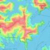
Mosman

Australia > New South Wales > Sydney

Altitude moyenne : 29 m

Katoomba

Australia > New South Wales

Altitude moyenne : 904 m

Newcastle

Australia > New South Wales > Newcastle

Altitude moyenne : 5 m

Blue Mountains

Australia > New South Wales

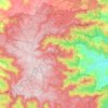
A sandstone plateau dominated by a landscape of endless eucalyptus forests, the Blue Mountains are located at the top of a 470-million-year-old quartzite. In the Permian period, a shallow sea covered the region, when rivers brought shales, siltstones and mudstones. Then during the Mesozoic period, rivers…

Altitude moyenne : 566 m
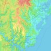
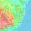
Central Coast Council

Australia > New South Wales

Altitude moyenne : 103 m

Inner West

Australia > New South Wales > Sydney

Altitude moyenne : 19 m

Inner West

Australia > New South Wales > Sydney

Altitude moyenne : 19 m

Griffith

Australia > New South Wales

Altitude moyenne : 131 m

Cooranbong

Australia > New South Wales

Altitude moyenne : 72 m

Glen Innes

Australia > New South Wales

Altitude moyenne : 1’083 m

Camden Council

Australia > New South Wales > Sydney

Altitude moyenne : 90 m

Normanhurst

Australia > New South Wales

Altitude moyenne : 165 m

Wilberforce

Australia > New South Wales

Altitude moyenne : 24 m

Possum Creek

Australia > New South Wales

Altitude moyenne : 78 m

Moruya

Australia > New South Wales

Altitude moyenne : 37 m

Nowra

Australia > New South Wales

Altitude moyenne : 21 m

Coogee

Australia > New South Wales

Altitude moyenne : 35 m

Orange

Australia > New South Wales

Orange is a city in the Central Tablelands region of New South Wales, Australia. It is 254 km (158 mi) west of the state capital, Sydney [206 km (128 mi) on a great circle], at an altitude of 862 metres (2,828 ft). Orange had an estimated urban population of 40,493 as of June 2018 making the city a significant…

Altitude moyenne : 852 m

Murrurundi

Australia > New South Wales

Altitude moyenne : 641 m

South Durras

Australia > New South Wales

Altitude moyenne : 32 m

Turon River

Australia > New South Wales

Altitude moyenne : 817 m

Parramatta

Australia > New South Wales

Altitude moyenne : 22 m

Armidale

Australia > New South Wales

Altitude moyenne : 1’036 m

Goulburn

Australia > New South Wales

Owing to its elevation, Goulburn has an oceanic climate (Cfb) with warm summers and cool winters; with a high diurnal range. Its climate is variable much of the year, though generally dry with maximum temperatures ranging from 11.8 °C (53.2 °F) in July to 28.3 °C (82.9 °F) in January. Rainfall is…

Altitude moyenne : 666 m
St Ives

Australia > New South Wales > Sydney

Altitude moyenne : 125 m

Engadine

Australia > New South Wales > Sydney

Altitude moyenne : 121 m

Illawarra

Australia > New South Wales

Altitude moyenne : 234 m

Bar Point

Australia > New South Wales

Altitude moyenne : 76 m

Barrington Tops

Australia > New South Wales

Altitude moyenne : 1’107 m

Campbelltown

Australia > New South Wales

Altitude moyenne : 96 m

Byron Bay

Australia > New South Wales

Byron Bay, located in northeastern New South Wales, Australia, is characterized by diverse topography shaped by its geological history. The town is part of the erosion caldera of the ancient Tweed Volcano, which erupted approximately 23 million years ago, resulting in the rich volcanic soils that define the…

Altitude moyenne : 7 m

Lithgow City Council

Australia > New South Wales

Altitude moyenne : 713 m

Brighton-Le-Sands

Australia > New South Wales > Sydney

Altitude moyenne : 6 m

Maroubra

Australia > New South Wales

Altitude moyenne : 27 m

Hornsby

Australia > New South Wales > Sydney

Altitude moyenne : 160 m

Kenthurst

Australia > New South Wales > Sydney

Altitude moyenne : 100 m
Redhead

Australia > New South Wales > Newcastle

Altitude moyenne : 30 m

Ryde

Australia > New South Wales > Sydney

Altitude moyenne : 52 m

Hurlstone Park

Australia > New South Wales > Sydney

Altitude moyenne : 24 m

Chillingham

Australia > New South Wales

Altitude moyenne : 94 m

Bendalong

Australia > New South Wales

Altitude moyenne : 19 m

Melonba

Australia > New South Wales

Altitude moyenne : 20 m

Iluka

Australia > New South Wales

Altitude moyenne : 2 m

Picton

Australia > New South Wales

Altitude moyenne : 227 m

Wahroonga

Australia > New South Wales

Altitude moyenne : 159 m

Terrigal

Australia > New South Wales

Altitude moyenne : 13 m

Granville

Australia > New South Wales

Altitude moyenne : 17 m

Bega

Australia > New South Wales

Altitude moyenne : 44 m

Ocean Shores

Australia > New South Wales

Altitude moyenne : 12 m

Tocumwal

Australia > New South Wales

Altitude moyenne : 112 m

Tweed Shire Council

Australia > New South Wales

Altitude moyenne : 212 m

Banora Point

Australia > New South Wales

Altitude moyenne : 17 m

Hawkesbury River

Australia > New South Wales

Altitude moyenne : 130 m

Kingscliff

Australia > New South Wales

Altitude moyenne : 5 m

Coraki

Australia > New South Wales

Altitude moyenne : 6 m

Braidwood

Australia > New South Wales

Altitude moyenne : 674 m

Nelson Bay

Australia > New South Wales

Altitude moyenne : 23 m

Castle Hill

Australia > New South Wales

Altitude moyenne : 123 m

Nambucca Heads

Australia > New South Wales

Altitude moyenne : 16 m

East Branxton

Australia > New South Wales

Altitude moyenne : 50 m

Malua Bay

Australia > New South Wales

Altitude moyenne : 22 m

Tumut

Australia > New South Wales

Altitude moyenne : 355 m

Belmont

Australia > New South Wales

Altitude moyenne : 14 m

Fairlight

Australia > New South Wales > Sydney

Altitude moyenne : 23 m

Merimbula

Australia > New South Wales

Altitude moyenne : 22 m

Cooperabung

Australia > New South Wales

Altitude moyenne : 69 m

Darlington Point

Australia > New South Wales

Altitude moyenne : 126 m

Deniliquin

Australia > New South Wales

Altitude moyenne : 94 m

Liverpool Range

Australia > New South Wales

Altitude moyenne : 475 m

Paterson

Australia > New South Wales

Altitude moyenne : 98 m

Bunnan

Australia > New South Wales

Altitude moyenne : 355 m

Merotherie

Australia > New South Wales

Altitude moyenne : 463 m

Frogs Hollow

Australia > New South Wales

Altitude moyenne : 81 m

Curban

Australia > New South Wales

Altitude moyenne : 277 m

Kiandra

Australia > New South Wales

Altitude moyenne : 1’432 m

Wombeyan Caves

Australia > New South Wales

Altitude moyenne : 738 m

Nashdale

Australia > New South Wales

Altitude moyenne : 951 m

Calderwood

Australia > New South Wales

Altitude moyenne : 100 m

Yass

Australia > New South Wales

Yass is located 280 km south-west of Sydney, on the Hume Highway. The Yass River, which is a tributary of the Murrumbidgee River, flows through the town. Yass is 59 km from Canberra; lying at an elevation of 505 m AMSL.

Altitude moyenne : 533 m

Annandale

Australia > New South Wales > Sydney

Altitude moyenne : 24 m

Avoca Beach

Australia > New South Wales

Altitude moyenne : 23 m

Moss Vale

Australia > New South Wales

Altitude moyenne : 673 m

Umina Beach

Australia > New South Wales

Altitude moyenne : 38 m

Manly

Australia > New South Wales

Altitude moyenne : 17 m

Équipez-vous pour votre prochaine aventure :

🪖Casques vélo et VTT - Protection en terrain accidenté
🔦Lampes frontales - Éclairage mains libres pour randonnée et bivouac
🎥Caméra d'action - Filmez vos descentes et vos ascensions en haute définition
🪢Mousquetons - Connecteurs indispensables en montagne
⛺Piquets de tente légers - Solidité et légèreté pour remplacer vos piquets d'origine

En tant que Partenaire Amazon, ce site perçoit une commission sur les achats éligibles sans surcoût pour vous.