
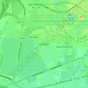
Carte topographique Stanwell
Carte interactive
Cliquez sur la carte pour afficher l’altitude.
À propos de cette carte
Nom : Carte topographique Stanwell, altitude, relief.
Altitude moyenne : 20 m
Altitude minimum : -1 m
Altitude maximum : 64 m
Autres cartes topographiques
Cliquez sur une carte pour visualiser sa topographie, son altitude et son relief.
Charlton
United Kingdom > England > Surrey > Borough of Spelthorne
Charlton, Borough of Spelthorne, Surrey, England, TW17 0ST, United Kingdom
Altitude moyenne : 13 m
Laleham
United Kingdom > England > Surrey > Borough of Spelthorne
Laleham, Borough of Spelthorne, Surrey, England, TW18 1SD, United Kingdom
Altitude moyenne : 14 m
Upper Halliford
United Kingdom > England > Surrey > Borough of Spelthorne
Upper Halliford, Borough of Spelthorne, Surrey, England, TW17 8SQ, United Kingdom
Altitude moyenne : 13 m
Pharaoh's Island
United Kingdom > England > Surrey > Borough of Spelthorne
Pharaoh's Island, Borough of Spelthorne, Surrey, England, TW17 9LN, United Kingdom
Altitude moyenne : 14 m
Shepperton
United Kingdom > England > Surrey > Borough of Spelthorne
Shepperton, Borough of Spelthorne, Surrey, England, United Kingdom
Altitude moyenne : 12 m
Ashford
United Kingdom > England > Surrey > Borough of Spelthorne
Ashford, Borough of Spelthorne, Surrey, England, United Kingdom
Altitude moyenne : 16 m