
Carte topographique Harwich Port
Carte interactive
Cliquez sur la carte pour afficher l’altitude.
À propos de cette carte
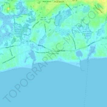
Nom : Carte topographique Harwich Port, altitude, relief.
Altitude moyenne : 3 m
Altitude minimum : -4 m
Altitude maximum : 23 m
Autres cartes topographiques
Cliquez sur une carte pour visualiser sa topographie, son altitude et son relief.
West Harwich
United States > Massachusetts > Barnstable County > Harwich
West Harwich, Harwich, Barnstable County, Massachusetts, 02671, United States
Altitude moyenne : 3 m
Pleasant Lake
United States > Massachusetts > Barnstable County > Harwich
Pleasant Lake, Harwich, Barnstable County, Massachusetts, 02631, United States
Altitude moyenne : 17 m