
Carte topographique Saqqez
Carte interactive
Cliquez sur la carte pour afficher l’altitude.
Saqqez
At an altitude of 1,476 metres (4,842 feet), Saqqez has a Mediterranean continental climate (Köppen climate classification Dsa) with hot, very dry summers and cold, snowy winters. Summers feature large diurnal temperature variation due to decreased air density at high altitude and low humidity. In 1969 Saqqez recorded a temperature of −36 °C (−33 °F), the lowest ever recorded by an Iranian weather station until Kheirabad Zanjan recorded −36.4 °C (−33.5 °F) on January 29, 1997.[13][14] Saqqez again reached −36 °C during the February 3–9 1972 Iran blizzard.
À propos de cette carte
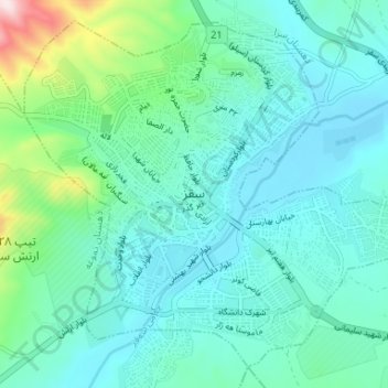
Nom : Carte topographique Saqqez, altitude, relief.
Altitude moyenne : 1’527 m
Altitude minimum : 1’448 m
Altitude maximum : 1’893 m
Autres cartes topographiques
Cliquez sur une carte pour visualiser sa topographie, son altitude et son relief.