
Carte topographique Hickory Ridge
Carte interactive
Cliquez sur la carte pour afficher l’altitude.
À propos de cette carte
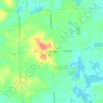
Nom : Carte topographique Hickory Ridge, altitude, relief.
Altitude moyenne : 326 m
Altitude minimum : 307 m
Altitude maximum : 362 m
Autres cartes topographiques
Cliquez sur une carte pour visualiser sa topographie, son altitude et son relief.
Seven Harbors
United States > Michigan > Oakland County > Highland Charter Township
Seven Harbors, Highland Charter Township, Oakland County, Michigan, 48356, United States
Altitude moyenne : 314 m
Waterbury Lake
United States > Michigan > Oakland County > Highland Charter Township
Waterbury Lake, Highland Charter Township, Oakland County, Michigan, United States
Altitude moyenne : 308 m
Veterans Park
United States > Michigan > Oakland County > Highland Charter Township
Veterans Park, Highland Charter Township, Oakland County, Michigan, 48357, United States
Altitude moyenne : 310 m