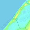
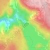
Carte topographique Bell Gorge
Cliquez sur la carte pour afficher l’altitude.
À propos de cette carte

Nom : Carte topographique Bell Gorge, altitude, relief.
Altitude moyenne : 335 m
Altitude minimum : 244 m
Altitude maximum : 444 m
Autres cartes topographiques
Cliquez sur une carte pour visualiser sa topographie, son altitude et son relief.






Rockingham
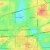
Rockingham is topographically flat, has sandy soils and coastal vegetation. It has a northern aspect to Cockburn Sound, from Rockingham Beach and Palm Beach.
Altitude moyenne : 4 m















Henley Brook
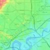
Henley Brook is situated on the flood plains of the Swan River, with regularly occurring seasonal floods. Two ephemeral streams from the river - Henley Brook and St. Leonard's Creek - traverse the suburb. Henley Brook is in the north-east near Brockman Street, while St Leonards Creek traverses the centre of…
Altitude moyenne : 28 m