
Carte topographique Village of Depew
Carte interactive
Cliquez sur la carte pour afficher l’altitude.
À propos de cette carte
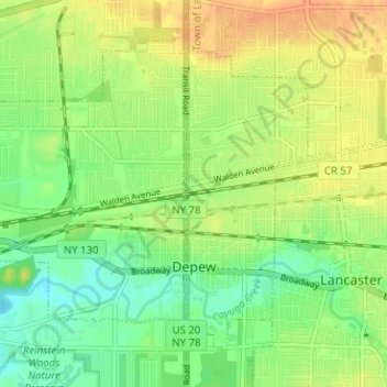
Nom : Carte topographique Village of Depew, altitude, relief.
Altitude moyenne : 208 m
Altitude minimum : 190 m
Altitude maximum : 227 m
Autres cartes topographiques
Cliquez sur une carte pour visualiser sa topographie, son altitude et son relief.
East Lancaster
United States > New York > Erie County > Town of Lancaster
East Lancaster, Town of Lancaster, Erie County, New York, 14086, United States
Altitude moyenne : 216 m
Bowmansville
United States > New York > Erie County > Town of Lancaster
Bowmansville, Town of Lancaster, Erie County, New York, 14026, United States
Altitude moyenne : 215 m
Lancaster
United States > New York > Erie County > Town of Lancaster
Lancaster, Town of Lancaster, Erie County, New York, United States
Altitude moyenne : 224 m