Géolocaliser

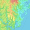
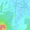
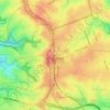
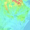
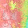
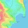
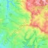
Carte topographique Gosford

Cliquez sur la carte pour afficher l’altitude.

À propos de cette carte

Nom : Carte topographique Gosford, altitude, relief.

Lieu : Gosford, Central Coast Council, New South Wales, 2250, Australia (-33.58502 151.18173 -33.26502 151.50173)

Altitude moyenne : 75 m

Altitude minimum : -4 m

Altitude maximum : 349 m

Autres cartes topographiques

Cliquez sur une carte pour visualiser sa topographie, son altitude et son relief.
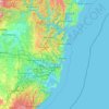
Sydney

Australia > New South Wales

Sydney's topography is characterized by a diverse landscape that seamlessly blends coastal features with inland plateaus. The city is divided into two primary regions: the relatively flat Cumberland Plain to the south and west of Sydney Harbour, and the elevated Hornsby Plateau to the north. The Cumberland…

Altitude moyenne : 51 m

Karangi

Australia > New South Wales

Altitude moyenne : 173 m

Central Coast Council

Australia > New South Wales

Altitude moyenne : 103 m

Wentworth Falls

Australia > New South Wales > Sydney

Wentworth Falls (postcode: 2782) is a town in the Blue Mountains region of New South Wales, situated approximately 100 kilometres (62 mi) west of the Sydney central business district, and about 8 kilometres (5.0 mi) east of Katoomba, Australia on the Great Western Highway, with a Wentworth Falls railway…

Altitude moyenne : 708 m

Lismore

Australia > New South Wales

Altitude moyenne : 23 m

Newcastle

Australia > New South Wales > Newcastle

Altitude moyenne : 5 m

Katoomba

Australia > New South Wales

Altitude moyenne : 904 m

Wauchope

Australia > New South Wales

Altitude moyenne : 32 m

Sydney

Australia > New South Wales > Sydney

Altitude moyenne : 23 m

Barrington Tops

Australia > New South Wales

Altitude moyenne : 1’107 m

Moruya

Australia > New South Wales

Altitude moyenne : 37 m

Scotts Head

Australia > New South Wales

Altitude moyenne : 5 m

Dubbo

Australia > New South Wales

Altitude moyenne : 318 m

Parramatta

Australia > New South Wales

Altitude moyenne : 22 m

Penrith

Australia > New South Wales > Sydney > Penrith

Penrith is a city in New South Wales, Australia, located in Greater Western Sydney, 55 kilometres (31 mi) west of the Sydney central business district on the banks of the Nepean River, on the outskirts of the Cumberland Plain. Its elevation is 32 metres (105 ft).

Altitude moyenne : 34 m
Windsor

Australia > New South Wales

Altitude moyenne : 12 m

Orange

Australia > New South Wales

Orange is a city in the Central Tablelands region of New South Wales, Australia. It is 254 km (158 mi) west of the state capital, Sydney [206 km (128 mi) on a great circle], at an altitude of 862 metres (2,828 ft). Orange had an estimated urban population of 40,493 as of June 2018 making the city a significant…

Altitude moyenne : 852 m

Bents Basin State Conservation Area

Australia > New South Wales > Sydney

The park is popular for swimming, kayaking, bushwalking, camping (with 100 tent sites), barbecuing, picnicking and fishing. The park also features walking trails within a bushland and an education centre with a commercial kitchen. Caley's Lookout Track, a walking track within the bushland, leads to Little…

Altitude moyenne : 82 m
Armidale

Australia > New South Wales

Altitude moyenne : 1’036 m

Port Macquarie

Australia > New South Wales

Altitude moyenne : 5 m

Alstonville

Australia > New South Wales

Altitude moyenne : 131 m

Chatswood

Australia > New South Wales

Altitude moyenne : 81 m

Caves Beach

Australia > New South Wales

Altitude moyenne : 22 m

Gulmarrad

Australia > New South Wales

Altitude moyenne : 10 m

Laurel Hill

Australia > New South Wales

Altitude moyenne : 990 m

Bonalbo

Australia > New South Wales

Altitude moyenne : 263 m

Northern Beaches

Australia > New South Wales > Sydney

Altitude moyenne : 67 m

Werri Beach

Australia > New South Wales

Altitude moyenne : 9 m

Carabost

Australia > New South Wales

Altitude moyenne : 484 m

Ulong

Australia > New South Wales

Altitude moyenne : 559 m

Fingal Bay

Australia > New South Wales

Altitude moyenne : 13 m

Bargo

Australia > New South Wales

Altitude moyenne : 346 m

Akolele

Australia > New South Wales

Altitude moyenne : 15 m

Oallen

Australia > New South Wales

Altitude moyenne : 593 m

Yass

Australia > New South Wales

Yass is located 280 km south-west of Sydney, on the Hume Highway. The Yass River, which is a tributary of the Murrumbidgee River, flows through the town. Yass is 59 km from Canberra; lying at an elevation of 505 m AMSL.

Altitude moyenne : 533 m
Goulburn

Australia > New South Wales

Owing to its elevation, Goulburn has an oceanic climate (Cfb) with warm summers and cool winters; with a high diurnal range. Its climate is variable much of the year, though generally dry with maximum temperatures ranging from 11.8 °C (53.2 °F) in July to 28.3 °C (82.9 °F) in January. Rainfall is…

Altitude moyenne : 666 m
Byron Bay

Australia > New South Wales

Byron Bay, located in northeastern New South Wales, Australia, is characterized by diverse topography shaped by its geological history. The town is part of the erosion caldera of the ancient Tweed Volcano, which erupted approximately 23 million years ago, resulting in the rich volcanic soils that define the…

Altitude moyenne : 7 m
Pooncarie

Australia > New South Wales > Pooncarie

Altitude moyenne : 68 m

Burramoko Ridge

Australia > New South Wales

Altitude moyenne : 920 m

Edensor Park

Australia > New South Wales > Sydney

Altitude moyenne : 57 m

Bowral

Australia > New South Wales

Altitude moyenne : 690 m

Lithgow City Council

Australia > New South Wales

Altitude moyenne : 713 m

Blackheath

Australia > New South Wales

Blackheath (postcode: 2785) is an Australian town located near the highest point of the Blue Mountains, between Katoomba and Mount Victoria in New South Wales. The town's altitude is about 1,065 metres (3,494 ft) AHD  and it is located about 120 kilometres (75 mi) west north-west of Sydney, 11 kilometres…

Altitude moyenne : 893 m
Mudgee

Australia > New South Wales

Altitude moyenne : 535 m

Glenfield

Australia > New South Wales > Sydney

Altitude moyenne : 29 m

Roseville

Australia > New South Wales > Sydney

Altitude moyenne : 84 m

Wollongbar

Australia > New South Wales

Altitude moyenne : 134 m

Allambie Heights

Australia > New South Wales > Sydney

Altitude moyenne : 77 m

Asquith

Australia > New South Wales

Altitude moyenne : 168 m

Wollemi National Park

Australia > New South Wales

Altitude moyenne : 521 m

Kiama

Australia > New South Wales

Altitude moyenne : 29 m

Gosford

Australia > New South Wales > Gosford

Altitude moyenne : 25 m

Charlestown

Australia > New South Wales

Altitude moyenne : 71 m

Bondi Beach

Australia > New South Wales > Sydney

Altitude moyenne : 31 m

Kangaroo Valley

Australia > New South Wales

Altitude moyenne : 320 m

Merewether

Australia > New South Wales > Newcastle

Altitude moyenne : 23 m

Fern Bay

Australia > New South Wales > Newcastle

Altitude moyenne : 4 m

Swan Bay

Australia > New South Wales

Altitude moyenne : 5 m

Goonengerry

Australia > New South Wales

Altitude moyenne : 152 m

Tahmoor

Australia > New South Wales

Altitude moyenne : 269 m

St Ives

Australia > New South Wales > Sydney

Altitude moyenne : 125 m

Manly

Australia > New South Wales

Altitude moyenne : 17 m

Moree

Australia > New South Wales

Altitude moyenne : 216 m

Robertson

Australia > New South Wales

Altitude moyenne : 545 m

Perisher Valley

Australia > New South Wales

Altitude moyenne : 1’704 m

Bossley Park

Australia > New South Wales

Altitude moyenne : 55 m

Ocean Shores

Australia > New South Wales

Altitude moyenne : 12 m

Tweed Shire Council

Australia > New South Wales

Altitude moyenne : 212 m

Banora Point

Australia > New South Wales

Altitude moyenne : 17 m

Nelson Bay

Australia > New South Wales

Altitude moyenne : 23 m

Castle Hill

Australia > New South Wales

Altitude moyenne : 123 m

Gerringong

Australia > New South Wales

Altitude moyenne : 37 m

Cowra

Australia > New South Wales

Altitude moyenne : 379 m

East Branxton

Australia > New South Wales

Altitude moyenne : 50 m

Clarence Town

Australia > New South Wales

Altitude moyenne : 62 m

Mount Fairy

Australia > New South Wales

Altitude moyenne : 767 m

Valla

Australia > New South Wales

Altitude moyenne : 45 m

Old Bonalbo

Australia > New South Wales

Altitude moyenne : 190 m

Batehaven

Australia > New South Wales

Altitude moyenne : 16 m

Coonabarabran

Australia > New South Wales

Altitude moyenne : 556 m

High Range

Australia > New South Wales

Altitude moyenne : 569 m

Kootingal

Australia > New South Wales

Altitude moyenne : 547 m

Wootton

Australia > New South Wales

Altitude moyenne : 102 m

Valla Beach

Australia > New South Wales

Altitude moyenne : 18 m

Gooloogong

Australia > New South Wales

Altitude moyenne : 335 m

Tarana

Australia > New South Wales

Altitude moyenne : 920 m

Four Mile Creek

Australia > New South Wales

Altitude moyenne : 831 m

Bimberi

Australia > New South Wales

Altitude moyenne : 1’317 m

Paxton

Australia > New South Wales

Altitude moyenne : 125 m

Old Adaminaby

Australia > New South Wales

Altitude moyenne : 1’172 m

Berry Mountain

Australia > New South Wales

Altitude moyenne : 216 m

Waverton

Australia > New South Wales > Sydney

Altitude moyenne : 33 m

Équipez-vous pour votre prochaine aventure :

👒Bandeau de sport hiver - Protégez vos oreilles du froid sans surchauffe
🍽️Popotes de camping - Ustensiles légers pour repas en bivouac
📱Support Smartphone VTT - Gardez vos cartes topographiques numériques visibles sur votre guidon
🧥Vestes imperméables de randonnée - Protection contre la pluie et le vent en terrain variable
🗺️Cartes de randonnée - Le support papier indispensable en complément du numérique

En tant que Partenaire Amazon, ce site perçoit une commission sur les achats éligibles sans surcoût pour vous.