

Carte topographique Chestnut Hill
Cliquez sur la carte pour afficher l’altitude.
Chestnut Hill
The village of Chestnut Hill was part of the German Township laid out by Francis Daniel Pastorius and came to include the settlements originally known as Sommerhausen and Crefeld, as well as part of Cresheim. It served as a gateway between Philadelphia and the nearby farmlands. During the American Revolutionary War era (late 18th century), the area was one of many summer vacation spots due to its higher elevation, 400–500 feet (120 to 150 m) above sea level, and cooler temperatures than the historic Center City. Chestnut Hill is still stereotypically known as one of the more affluent sections of Philadelphia. However, there are many residents who fall within lower/middle class incomes.
À propos de cette carte

Nom : Carte topographique Chestnut Hill, altitude, relief.
Altitude moyenne : 97 m
Altitude minimum : 32 m
Altitude maximum : 138 m
Autres cartes topographiques
Cliquez sur une carte pour visualiser sa topographie, son altitude et son relief.

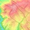
Pastorius Park
United States > Pennsylvania > Philadelphia County > Philadelphia
Altitude moyenne : 108 m
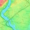
Strawberry Mansion
United States > Pennsylvania > Philadelphia County > Philadelphia
Altitude moyenne : 31 m
East Passyunk Community Recreation Center
United States > Pennsylvania > Philadelphia County > Philadelphia
Altitude moyenne : 9 m
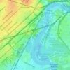
Bartram's Garden
United States > Pennsylvania > Philadelphia County > Philadelphia
Altitude moyenne : 13 m