
Carte topographique Holzbachschlucht
Carte interactive
Cliquez sur la carte pour afficher l’altitude.
À propos de cette carte
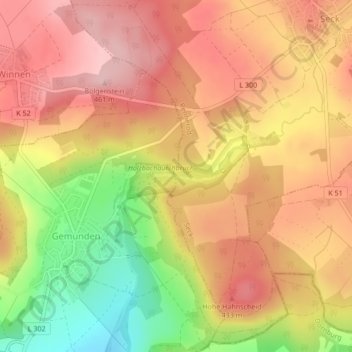
Nom : Carte topographique Holzbachschlucht, altitude, relief.
Altitude moyenne : 384 m
Altitude minimum : 265 m
Altitude maximum : 460 m
Autres cartes topographiques
Cliquez sur une carte pour visualiser sa topographie, son altitude et son relief.
Seck
Germany > Rhineland-Palatinate > Westerwaldkreis > Seck
Seck, Rennerod, Westerwaldkreis, Rhineland-Palatinate, Germany
Altitude moyenne : 416 m