
Carte topographique Selånger District
Carte interactive
Cliquez sur la carte pour afficher l’altitude.
À propos de cette carte
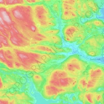
Nom : Carte topographique Selånger District, altitude, relief.
Altitude moyenne : 135 m
Altitude minimum : -2 m
Altitude maximum : 359 m
Autres cartes topographiques
Cliquez sur une carte pour visualiser sa topographie, son altitude et son relief.
Sandslån
Sweden > Västernorrland County > Ytterlännäs District
Sandslån, Ytterlännäs District, Kramfors kommun, Västernorrland County, Sweden
Altitude moyenne : 11 m