
Carte topographique Rockwell Green
Carte interactive
Cliquez sur la carte pour afficher l’altitude.
À propos de cette carte
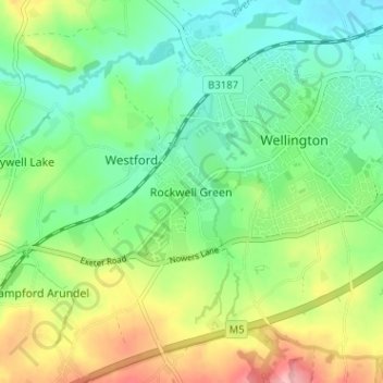
Nom : Carte topographique Rockwell Green, altitude, relief.
Altitude moyenne : 88 m
Altitude minimum : 40 m
Altitude maximum : 178 m
Autres cartes topographiques
Cliquez sur une carte pour visualiser sa topographie, son altitude et son relief.
Tonedale
United Kingdom > England > Somerset > Wellington > Lower Westford
Tonedale, Lower Westford, Wellington, Somerset, England, TA21 0AE, United Kingdom
Altitude moyenne : 72 m