
Carte topographique Sri Muktsar Sahib
Carte interactive
Cliquez sur la carte pour afficher l’altitude.
À propos de cette carte
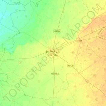
Nom : Carte topographique Sri Muktsar Sahib, altitude, relief.
Altitude moyenne : 197 m
Altitude minimum : 185 m
Altitude maximum : 207 m
The average land elevation of the city is 648.52 feet (197.67 metres) above sea level. Lithologically, Muktsar is a part of the vast Indo-Gangetic alluvial plain, composed of alternate bands of sands, silt and clay with pebbles. Sandy plains, sand dunes and topographic depressions are the common landforms.