
Carte topographique Sermersooq
Carte interactive
Cliquez sur la carte pour afficher l’altitude.
À propos de cette carte
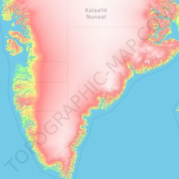
Nom : Carte topographique Sermersooq, altitude, relief.
Lieu : Sermersooq, Groenland (60.85019 -52.79009 71.94284 -20.78094)
Altitude moyenne : 1’116 m
Altitude minimum : -2 m
Altitude maximum : 3’402 m
Autres cartes topographiques
Cliquez sur une carte pour visualiser sa topographie, son altitude et son relief.