
Faire un don
Équipez-vous pour votre prochaine aventure :
En tant que Partenaire Amazon, ce site perçoit une commission sur les achats éligibles sans surcoût pour vous.
Carte topographique Irlam
Cliquez sur la carte pour afficher l’altitude.
Faire un don
Équipez-vous pour votre prochaine aventure :
En tant que Partenaire Amazon, ce site perçoit une commission sur les achats éligibles sans surcoût pour vous.
À propos de cette carte
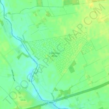
Nom : Carte topographique Irlam, altitude, relief.
Altitude moyenne : 21 m
Altitude minimum : 11 m
Altitude maximum : 29 m
Faire un don
Équipez-vous pour votre prochaine aventure :
En tant que Partenaire Amazon, ce site perçoit une commission sur les achats éligibles sans surcoût pour vous.
Autres cartes topographiques
Cliquez sur une carte pour visualiser sa topographie, son altitude et son relief.
Swinton
United Kingdom > England > Salford
Swinton lies at 53°30′44″N 2°20′28″W / 53.51222°N 2.34111°W / 53.51222; -2.34111 (53.5122°, -2.3412°), 167 miles (269 km) northwest of central London, and 4.2 miles (6.8 km) west-northwest of Manchester city centre. Topographically, Swinton occupies an area of gently sloping ground,…
Altitude moyenne : 59 m
Faire un don
Équipez-vous pour votre prochaine aventure :
En tant que Partenaire Amazon, ce site perçoit une commission sur les achats éligibles sans surcoût pour vous.
Pendlebury
United Kingdom > England > Salford
Pendlebury is situated on a ridge overlooking the lower Irwell Valley, almost midway between Manchester and Bolton and is neighboured by Irlams o' th' Height, Pendleton and Clifton. Much of the boundary between Pendlebury and Clifton is defined by Slack Brook which was culverted many years ago after the area…
Altitude moyenne : 64 m
Faire un don
Équipez-vous pour votre prochaine aventure :
En tant que Partenaire Amazon, ce site perçoit une commission sur les achats éligibles sans surcoût pour vous.
Faire un don
Équipez-vous pour votre prochaine aventure :
En tant que Partenaire Amazon, ce site perçoit une commission sur les achats éligibles sans surcoût pour vous.