
Carte topographique Quarter 1 of District 7
Carte interactive
Cliquez sur la carte pour afficher l’altitude.
À propos de cette carte
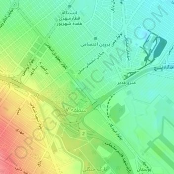
Nom : Carte topographique Quarter 1 of District 7, altitude, relief.
Altitude moyenne : 994 m
Altitude minimum : 967 m
Altitude maximum : 1’037 m
Autres cartes topographiques
Cliquez sur une carte pour visualiser sa topographie, son altitude et son relief.
Mountain Park
Iran > Razavi Khorasan > Mashhad County > Mashhad
Mountain Park, District 9, Mashhad, بخش مرکزی شهرستان مشهد, Mashhad County, Razavi Khorasan, Iran
Altitude moyenne : 1’282 m
Shahid Razavi
Iran > Razavi Khorasan > Mashhad County > Mashhad
Shahid Razavi, Quarter 1 of District 11, District 11, Mashhad, بخش مرکزی شهرستان مشهد, Mashhad County, Razavi Khorasan, Iran
Altitude moyenne : 1’048 m