
Carte topographique Fernie
Carte interactive
Cliquez sur la carte pour afficher l’altitude.
À propos de cette carte
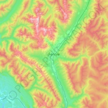
Nom : Carte topographique Fernie, altitude, relief.
Altitude moyenne : 1’551 m
Altitude minimum : 794 m
Altitude maximum : 2’835 m
Autres cartes topographiques
Cliquez sur une carte pour visualiser sa topographie, son altitude et son relief.
Maiden Lake
Canada > British Columbia > Regional District of East Kootenay > Fernie
Maiden Lake, Fernie, Regional District of East Kootenay, British Columbia, Canada
Altitude moyenne : 1’045 m