
Carte topographique Gunung Samarinda
Carte interactive
Cliquez sur la carte pour afficher l’altitude.
À propos de cette carte
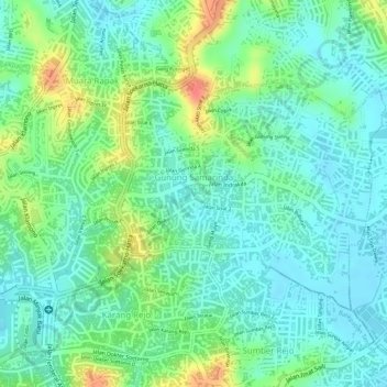
Nom : Carte topographique Gunung Samarinda, altitude, relief.
Altitude moyenne : 25 m
Altitude minimum : 5 m
Altitude maximum : 65 m
Autres cartes topographiques
Cliquez sur une carte pour visualiser sa topographie, son altitude et son relief.
Klandasan Ilir
Indonésie > Kalimantan oriental > Balikpapan
Klandasan Ilir, Balikpapan, Kalimantan oriental, 76121, Indonésie
Altitude moyenne : 17 m