
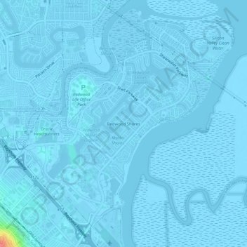
Carte topographique Redwood Shores
Carte interactive
Cliquez sur la carte pour afficher l’altitude.
À propos de cette carte
Nom : Carte topographique Redwood Shores, altitude, relief.
Altitude moyenne : 0 m
Altitude minimum : -6 m
Altitude maximum : 72 m
Autres cartes topographiques
Cliquez sur une carte pour visualiser sa topographie, son altitude et son relief.
Farm Hills
United States > California > San Mateo County > Redwood City
Farm Hills, Redwood City, San Mateo County, CAL Fire Northern Region, California, 94062, United States
Altitude moyenne : 103 m
Redwood Junction
United States > California > San Mateo County > Redwood City
Redwood Junction, Redwood City, San Mateo County, CAL Fire Northern Region, California, 94063, United States
Altitude moyenne : 9 m
Redwood City
United States > California > San Mateo County > Redwood City
Redwood City, San Mateo County, California, 94063, United States
Altitude moyenne : 101 m