
Carte topographique Jiroft
Carte interactive
Cliquez sur la carte pour afficher l’altitude.
À propos de cette carte
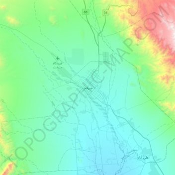
Nom : Carte topographique Jiroft, altitude, relief.
Altitude moyenne : 896 m
Altitude minimum : 583 m
Altitude maximum : 2’392 m
Jiroft is located in a vast plain, Halil River, on the southern outskirts of the Jebal Barez mountain chain, surrounded by two rivers. The mean elevation of the city is about 650 metres (2,130 ft) above sea level. The weather of the city is sweltering in summer – it is one of the hottest places in Iran – but temperatures are moderate in winter.