
Carte topographique Vesturhöfn
Carte interactive
Cliquez sur la carte pour afficher l’altitude.
À propos de cette carte
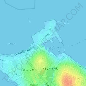
Nom : Carte topographique Vesturhöfn, altitude, relief.
Lieu : Vesturhöfn, Vesturbær, Reykjavik, Capital Region, Iceland (64.15027 -21.95208 64.15720 -21.93325)
Altitude moyenne : 4 m
Altitude minimum : -1 m
Altitude maximum : 36 m
Autres cartes topographiques
Cliquez sur une carte pour visualiser sa topographie, son altitude et son relief.