
Carte topographique Birjand
Carte interactive
Cliquez sur la carte pour afficher l’altitude.
À propos de cette carte
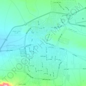
Nom : Carte topographique Birjand, altitude, relief.
Altitude moyenne : 1’499 m
Altitude minimum : 1’431 m
Altitude maximum : 1’884 m
Autres cartes topographiques
Cliquez sur une carte pour visualiser sa topographie, son altitude et son relief.
Mirik
Iran > South Khorasan Province > Birjand County > Mirik
Mirik, بخش مرکزی, Birjand County, South Khorasan Province, Iran
Altitude moyenne : 1’956 m
Abbasabad
Iran > South Khorasan Province > Birjand County > دهستان کاهشنگ > Qaleh Kuh > Abbasabad
Abbasabad, Qaleh Kuh, دهستان کاهشنگ, بخش مرکزی, Birjand County, South Khorasan Province, Iran
Altitude moyenne : 2’137 m