
Carte topographique Krishnanagar
Cliquez sur la carte pour afficher l’altitude.
Krishnanagar
Krishnanagar is located at 23°24′N 88°30′E / 23.4°N 88.5°E / 23.4; 88.5. The area of the municipality is around 16 km2. It is situated on the southern banks of the Jalangi River. It has an average elevation of 14 metres (46 ft). The Tropic of Cancer passes through the outskirts of Krishnanagar. The latitude of the Tropic of Cancer is 23° 26′ 5″ N.
À propos de cette carte
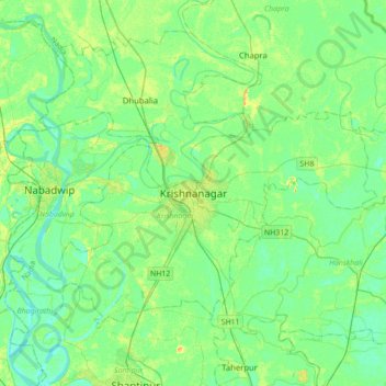
Nom : Carte topographique Krishnanagar, altitude, relief.
Lieu : Krishnanagar, Krishnagar-I, Nadia, West Bengal, 741101, India (23.24585 88.33589 23.56585 88.65589)
Altitude moyenne : 11 m
Altitude minimum : 3 m
Altitude maximum : 29 m